High styles
| High styles | |||
|---|---|---|---|
|
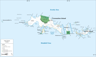
Map of Coronation Island (center) with Brisbane Heights and Mount Nivea between which the High Stile runs |
|||
| Pass height | 455 m | ||
| Coronation Island , South Orkney Islands | |||
| map | |||
|
|
|||
| Coordinates | 60 ° 35 ′ 0 ″ S , 45 ° 30 ′ 0 ″ W | ||
High Stile (English for high stile ) is a 455 m high mountain pass in the center of Coronation Island in the archipelago of the South Orkney Islands . It is located at the junction between the southwestern ridge of Mount Nivea and the eastern end of Brisbane Heights .
The descriptive naming of the pass was made by the Falkland Islands Dependencies Survey in the course of a survey campaign that lasted from 1948 to 1949.
Web links
- High Stile in the Geographic Names Information System of the United States Geological Survey (English)
- High styles on geographic.org (English)

