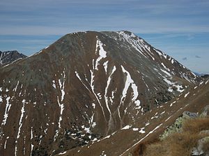
Hochreichhart
| Hochreichhart | ||
|---|---|---|
|
The Hochreichhart (center back) |
||
| height | 2416 m above sea level A. | |
| location | Styria , Austria | |
| Mountains | Seckauer Tauern , Lower Tauern | |
| Dominance | 3.7 km → Geierhaupt | |
| Notch height | 336 m ↓ Hölltalsattel | |
| Coordinates | 47 ° 21 '48 " N , 14 ° 40' 55" E | |
|
|
||
| rock | Granite and gneiss granite | |
The Hochreichhart (also Hochreichart ) is a 2416 m above sea level. A. high mountain in Upper Styria . It is located north of Gaal and is the second highest mountain in the Seckauer Tauern .
Hiking trails lead to the mountain from the north ( Hochreichart-Schutzhaus ) as well as from the southwest from the Ingeringgraben. From the Ingeringgraben the path begins around 2 km before the Ingeringsee . From there you can either go over the Brandstättertörl or over the Schmähhausücken to the Hochreichhart. The last 400 meters of altitude from Brandstättertörl require surefootedness and a head for heights. The ascent from the northwest over the Hirschkarlgrat requires climbing in the I. u. II. Difficulty level .
literature
- K. Schittengruber: The vegetation of the Seckauer Zinken and Hochreichart in Styria. In: Communications from the Natural Science Association for Styria 91 (1961), 105–141.
Web links
Commons : Hochreichhart - collection of images, videos and audio files

