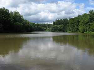
Sulzbach flood retention basin
| Sulzbach flood retention basin | |||||||||
|---|---|---|---|---|---|---|---|---|---|
| Sulzbach flood retention basin | |||||||||
|
|||||||||
|
|
|||||||||
| Coordinates | 48 ° 39 '20 " N , 9 ° 6' 12" E | ||||||||
| Data on the structure | |||||||||
| Construction time: | 1983/1984 | ||||||||
| Height of the barrier structure : | 18 m | ||||||||
| Data on the reservoir | |||||||||
| Reservoir length | 500 m | ||||||||
| Reservoir width | 100 m | ||||||||
| Storage space | 740 000 m³ | ||||||||
| Catchment area | 15 km² | ||||||||
The Sulzbach flood retention basin , also known as the Sulzbach reservoir , is located on the Steinenbronn marker between Schönaich and Steinenbronn in the Böblingen district in Baden-Württemberg .
The Sulzbach is a tributary of the Aich . The small reservoir in natural surroundings is dammed up by an 18 m high earth dam. The flood retention basin is operated by the Aich water association.

