Hogolie
| High Kullge | ||
|---|---|---|
|
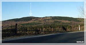
Widok na Okole z drogi 365 (Jelenia Góra - Legnica). Odległość w linii prostej: 2 km |
||
| height | 718 m | |
| location | Poland | |
| Mountains | Bober-Katzbach Mountains | |
| Coordinates | 50 ° 58 '51 " N , 15 ° 49' 5" E | |
|
|
||
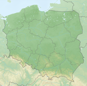
The Hogolie ( Polish Okole , German also: Hohe Kullge) is a 718 m high summit in the northern ridge of the Bober-Katzbach Mountains near Ludwigsdorf ( Chrośnica ), Lower Silesian Voivodeship . The Hohe Kullge and the Hohewaldberg ( Leśniak ) form a massif. The mountain consists of metamorphic rocks from the Old Paleozoic , particularly green slate, phyllites, quartzites and keratophyres. The summit area carries several mighty, steeply erect rock groups made of slate: the Adlerstein, the Gewitterstein, and the Scholzensteine.
In 2018, a new wooden viewing platform and hut were built on the summit. From the Hohe Kullge the view extends to the Blücherhöhe ( Łysa Góra ) in the main ridge of the Bober-Katzbach Mountains, the Landeshuter Ridge ( Rudawy Janowickie ), the Giant Mountains , the Probsthainer Spitzberg ( Ostrzyca ), as well as the Wolfsberg ( Wilcza Góra or Wilkołak ) and the Gröditzberg ( Grodziec ) near Goldberg ( Złotoryja ). When the visibility is very good, the Great Heuscheuer ( Szczeliniec Wielki ) can also be seen.
Individual evidence
- ↑ Dieter Biladt: From the Wartburg to Budapest . epubli, 2015 ( online ).
- ↑ Julius Ebert: The Giant Mountains, Jizera and Lusatian Mountains together with the Glatzer and Waldenburg Mountains, Breslau and the Zobten Mountains: a practical manual for travelers to the Sudeten . Goldschmidt, 1888.
- ^ W. Scharenberg: Handbook for travelers to the Sudeten with special consideration for friends of the natural sciences and visitors to Silesian medicinal springs . Trewendt, 1862.

