
Bober-Katzbach Mountains
| Bober-Katzbach Mountains | ||
|---|---|---|
 |
||
| Highest peak | Skopiec ( 718 m npm ) | |
| location | Poland | |
| part of | West Sudetes | |
|
||
| Coordinates | 50 ° 58 ′ N , 15 ° 51 ′ E | |

The Bober-Katzbach Mountains ( Góry Kaczawskie in Polish ) is a mountain range about 30 km long in front of the Giant Mountains to the north . It is an offshoot of the Sudetes and is located in the Polish Lower Silesian Voivodeship . The rivers Bober and Katzbach give it its name . The highest point is the Melkgelte / Skopiec (724 m). In front of the Bober-Katzbach Mountains in the north is the Bober-Katzbach foothills ( Pogórze Kaczawskie in Polish ), also Goldberger or Jauer Mountains ( Pogórze Złotoryjskie in Polish ).
location
The ridge running in north-west-south-east direction with altitudes between 400 and 700 m is a folded mountain range consisting of limestone, slate and dolomite . In the west, the Bober separates the Bober-Katzbach Mountains from the Jizera Mountains and Jizera Mountains Foreland , in the north is the Bober-Katzbach foothills, in the east the Angry Neisse / Nysa Szalona forms the border. In the southeast the Bober-Katzbach Mountains merge into the Waldenburger Bergland / Góry Wałbrzyskie. To the south, the Landeshuter Kamm / Rudawy Janowickie and the Hirschberger Valley form the transition to the Giant Mountains.
geology
The basic building block of the mountains is the so-called Giant Mountains granite. Various rocks occur locally, e.g. B. gneiss , slate , green stone / diabase , phyllite , quartz (sometimes with graphite), marble (crystalline limestone calcite and dolomite ), limestone, sandstone, porphyry and basalt . From a geological point of view, this part of the Sudetes is very diverse in formations that go back to the Cambrian era (approx. 500 million years). In the three southern mountain ranges there is a formation that consists of sedimentary rocks (sandstone, clay, which now appear as slate and phyllite) and rocks of organic origin (converted dolomite and limestone, including marble). The rhyolites and melaphyres in the area of Schwarzbach, as well as the pillow lava in the area of Lähn (Wleń) remind of the volcanic activity . As a result of later volcanic activity, tertiary basalts were formed in the vicinity of Mauer (Pilchowice) and Berbisdorf (Dziwiszów), as well as an agate deposit near Liebenthal (Lubiechowa) and Neukirch (Nowy Kościół).
The relief of the mountains was created during the Alpine orogeny period . The mountains got their final shape in the Pleistocene , when glaciers twice covered the area of the Bober-Katzbach Mountains. The glacier left deposits of till , gravel, sand and boulders. At the end of the Ice Age, the rift valleys of the Bóbr River near Jannowitz / Janowice Wielkie and Boberröhrsdorf / Siedlęcin were formed .
The limestone massifs near Kauffung with the Tschirnhaus lime works (Kitzelberg / Berg Połom) are also of particular importance . Some karst caves were also created there .
geography
The Bober-Katzbach Mountains consist of four different mountain ridges: north ridge, main or south ridge, small ridge and east ridge. The first three ridges mentioned extend in a north-west-south-east direction, the east ridge is located east of the Katzbach and forms an irregular shape. In many places there are rocks that are formed from different rocks, e.g. B. green stone / diabase , marble , slate, sandstone and conglomerate , and in return Bober amphibolite . One example is the so-called "small organ" near Moisdorf (Myślibórz) in the Bober-Katzbach foothills.

The centuries-old mining activity resulted in quarries (mainly limestone) and the original nature was greatly changed. The most famous example is Połom (Kitzelberg) - a limestone quarry with almost vertical walls - near Kauffung (Wojcieszów).
North ridge
The north ridge extends between the Bober (Bóbr) near Lähn (Wleń) and the Katzbach (Kaczawa) near Kauffung (Wojcieszów) north of the Lipka and Świerzawa valleys.
South ridge (including lead mountain ridge)
The south ridge (main ridge) extends south of the valley of the Lipka and the Świerzawa between Langenau ( Czernica ) and Merzdorf (Marciszów). Its eastern part is called the Bleibergkamm (Góry Ołowiane), this is located southeast of the Seiffersdorfer Pass (Przelęcz Radomierska, 523 m).
Small comb
The so-called Small Ridge is located south of the main ridge and north of Hirschberg (Jelenia Góra) and extends from Mauer (Pilchowice) to Berbisdorf (Dziwiszów).
East ridge
The east ridge is located east of the Katzbach valley between the places Kauffung (Wojcieszów), Ketschdorf (Kaczorów), Merzdorf (Marciszów), Thomasdorf (Domanów), Bolkenhain ( Bolków ), Leipe ( Lipa (Bolków) ), Kleinhelmsdorf (Dobków) and Altschönau (Stara Kraśnica).
Significant surveys
_im_Bober-Katzbach-Gebirge.jpg)
In the Bober-Katzbach foothills
West of the Katzbach
Falkenhainer Berge / Sokolowskie Wzgórza near Falkenhain / Sokolowice (Gr., Kl. Buchberg, Schafberg, Geiersberg); Probsthainer Spitzberg / Proboszczowice or Ostrzyca Proboszczowicka (501 m).
East of the Katzbach
Wolfsberg / Wilcza Gora or Wilkołak (373 m) near Goldberg / Złotoryja; Geiersberg (325 m); Willmannsdorfer Hochberg / Rosocha (464 m) near Willmannsdorf / Stanislawów; Willenberg / Wielislawka (370 m) near Röversdorf / Sedziszowa; Pombsener Spitzberg / Czartowska Skała (463 m) near Pombsen / Pomocne; Breiteberg / Bazaltowa Góra (368 m); Mochenberg / Mszana (475 m); Obloga (442 m); Janusberg / Radogost (398 m) near Moisdorf; Rathsberg / Rataj (350 m) near Moisdorf; Knabenkräuterhügel / Storczykowe Wzgórze (370 m); Mochauer Hills / Muchowskie Wzgórza.

In the north ridge
Hogolie (Ogule) / Okole (714 m); Waldberg / Leśniak (677 m); Scholzenstein / Sołtysie Skały (695 m); Zippelberg / Wywołaniec (543 m); Hornigberg / Rogatka (490 m); Steinberg / Skała (485 m); Frauenberg / Babiniec (486 m); Kuttenberg / Tarczynka (422 m); Galgenberg / Szubieniczna (325 m); Güntherhöhe / Pańska Wysoczka (658 m); Stumpen / Świerki (561 m); Gackowa (549 m); Freudenberg / Radostka (532 m); Klessenstein / Klęśniak (678 m).
In the main ridge
(Its western part is called Ludwigsdorfer Gebirge or Kamm / Chrośnickie Kopy, its eastern part is called the Bleibergkamm / Gory Ołowiane)
Kratzberg / Czernicka Góra (513 m); Bird or finch dump / Ptasia (626 m); Hölleberge / Lastek (638, 631 m); Knappenstein / Kazalnica (620 m); Blücherhöhe / Łysa Góra (707 m); Stangenberg / Leśnica (665 m); Kapellenberg / Widok (616 m); Zrobek (616 m); Old horse / Kobyła (626 m); Old horse / Ogier (646 m); Maślak (720 m) with Okopowa (715 m) and Folwarczna; Melkgelte / Skopiec (724 m); Schafberg / Baraniec (723 m); Grundhübel / Ziemski Kopczyk (672 m); Leszczyniec (604 m); Straconka (611 m); Galgenberg / Dudziarz (652 m); Kleiner Mühlberg / Młynicą (462 m); Moosberg / Meszną (590 m); Moosberg / Bożniak (613 m); Kitzelberg / Górą Połom (667 m).
In the lead mountain ridge
Rosengarten / Różanka (628 m); Bleiberg / Ołowiana (658 m); Schubertberg / Turzec (684 m); Prittwitzberg / Ciechanówka (598 m).
In the small comb
Grunauer Spitzberg / Stromiec (551 m); Galgenberg or Schieferberg / Górą Szybowcowa or Szybowisko (561 m); Silberberg / Srebrną (491 m); Kalkberge / Wapienną (507 m); Lerchenberg / Skowron (472 m); Strzyżową (424 m); Hartenberg / Czyżyk (425 m).
In the east ridge
Grosshau / Poręba (671 m); Waldberg / Lubrzy (666 m); Barstein / Niedźwiedzich Skałek (657 m); Skiby (562 m); Rakarnią (548 m); Rochowicką Skałą (495 m); Wapnikami (509 m); Młyniczną (454 m); Eisenkoppe / Żeleźniak (664 m); Wetzelberg / Osełką (581 m); Mühlberg / Miłek (569, 596, 573 m); Buchenberg / Bukowinka (621 m); Galgenberg / Głogowiec (535 m); Marienstein or Martenstein / Marcińcem (624 m); Rehberg / Rogacz (617 m); Repprichtsberg / Dłużkiem (592 m); Hopfenberg / Chmielar (585 m); Wiesenberge / Polanką (547 m); Rohrsberg / Trzciniec (469 m); Bielec (450 m); Galgenberg / Zadora (454 m); Lindenberg / Lipna (436 m); Rufferstein / Garb (404 m).
Special rock formations

- "Small organ" (basalt) on the Ratschberg near Moisdorf / Myślibórz
- "Large organ" (porphyry) on Willenberg / Wielislawka near Röversdorf / Sędziszowa
- Raven docks (sandstone walls) at Bad Hermsdorf / Jerzmanice-Zdrój station
- Basalt columns near Mochau / Muchów and Konradswaldau / Kondratów
- Limestone quarry on Kitzelberg with stalactite caves
- Rabenklippen near Jannowitz / Janowice Wielkie
- "Vandal Grave" / Grób Wandalów on the DW365 road between Hirschberg and Berbisdorf / Dziwiszów
Former volcanoes (basalt mountains, usually referred to as "Spitzberg"):
- Gröditzberg / Grodziec (407 m)
- Wolfsberg / Wilcza Góra or Wilkołak (367 m)
- Breiteberg / Bazaltowa Góra (368 m) near Poischwitz / Paszowice
- Ratschberg / Rataj (350 m) near Moisdorf / Myślibórz
- Heßberg / Górzec near Herrmansdorf / Męcinka
- Pombsener Spitzberg / Czartowska Skała (463 m)
- Probsthainer Spitzberg / Ostrzyca Proboszczowicka (501 m, called "Silesian Fujiyama")
- Mountains and rock formations in the Bober-Katzbach Mountains

Raven docking near Hermsdorf

Large rock organ near Röversdorf

Pombsener Spitzberg near Pombsen

Wolfsberg near Wolfsdorf
So-called vandal grave at DW365
.jpg)
.jpg)
.jpg)


Gorges and passes
- Leiper Gorge / Wąwóz Lipa
- Siebenhufen Gorge / Wąwóz Siedmicki
- Neudorf Gorge / Wąwóz Nowowiejski
- Moisdorf Gorge / Wąwóz Myślibórski
- Important passports
- Ludwigsdorfer Pass / Przelęcz Chrośnicka (561 m)
- Kapellenberger Sattel / Przelęcz Widok-Kapella (582 m)
- Pass / Przelęcz nad Kobyła (592 m)
- Kammerswaldauer Pass / Przelęcz Komarnicka (662 m)
- Seiffersdorfer Pass / Przelęcz Radomierska (523 m)
Nature parks
- Chelmy Landscape Park / Krajobrazowy Chełmy Park
- Landscape Park Unteres Bobertal / Park Krajobrazowy Doliny Bobru with Löwenberger Schweiz
- Landeshuter Kamm Landscape Park / Rudawski Park Krajobrazowy
Waters

The Bober-Katzbach Mountains are located in the Oder catchment area .
- Bober / Bóbr
- Fast Deichsa / Skorą
- Katzbach / Kaczawa
- Angry or Jauersche Neisse / Nysa Szalona with the left tributary of the Kleine Neisse / Nysa Mała
- Side valleys
- Steinbachtal from Schönau towards Reichwaldau - Mochau
- Rothebachtal near Falkenhain (tributary of the Schnellen Deichsa)
- Helmsbachtal from Schönau to Kleinhelmsdorf
- Erlenbachtal east of Kauffung (towards Altenberg)
- Mühlenbachtal between Neudorf and Siebenhufen
- Valley of the Kleine Neisse near Blumenau - Falkenberg
Selected locations in the Bober-Katzbach Mountains (including foothills)
.jpg)

- Yes / Yes
- Goldberg / Złotoryja
- Röversdorf / Sędziszowa
- Schönau an der Katzbach / Świerzawa
- Kauffung / Wojcieszów
- Probsthain / Proboszów
- Tiefhartmannsdorf / Radzyn
- Ludwigsdorf / Chrośnica
- Berbisdorf / Dziwiszów
- Ketschdorf / Kaczorów
- Kleinhelmsdorf / Dobków
- Leipe / Lipa
- Mochau / Muchów
- Konradswaldau / Kondratów
- Pombsen / Pomocne
- Willmannsdorf / Stanislawów
- Moisdorf / Myślibórz
Attractions

- Probsthain / Proboszów with a former Protestant church
- Tiefhartmannsdorf with observation tower and castle (former owner: Vitzthum von Eckstädt)
- Coordinate stone (51 ° N, 16 ° E) in the Mochau Forest (basalt column)
- Late Romanesque church of St. John and Catherine of Alexandria in Schönau an der Katzbach
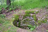
- Walońska Cave on the White Rocks (Białe Skały) north of Kammerswaldau (Komarno)
- Old arsenic mine near Altenberg (Radzimowice)
- Bolkoburg (Zamek Bolkow) and Schweinhausburg ( Zamek Świny ) near Bolkenhain ( Bolków )
literature
- Grieben travel guide Volume 18, Giant and Jizera Mountains, together with Lausitzer, Bober-Katzbach Mountains and Waldenburger Bergland , Grieben-Verlag, 1934, 253 pp.
Web links
- Bober-Katzbach Mountains - Sights
- Tourist guide - Bober-Katzbach foothills and mountains. (PDF, 55 MB) Accessed in 2014 .
- Artur Skowronek: The Kauffunger limestone (Bober-Katzbach Mountains, Poland) - petrography, fossil inventory, stratigraphy. (PDF, 65 MB) University of Hanover, accessed in 2001 .