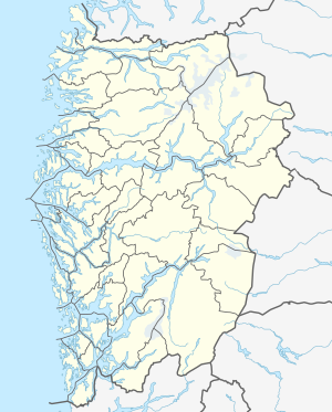
Hornindalsvatnet
| Hornindalsvatnet | ||
|---|---|---|

|
||
| Geographical location | Stad ( Vestland ), Hornindal ( Møre og Romsdal ) | |
| Drain | Eidselva → Nordfjord | |
| Data | ||
| Coordinates | 61 ° 55 ' N , 6 ° 10' E | |
|
|
||
| Altitude above sea level | 53 moh. | |
| surface | 50.42 km² | |
| volume | 12.06 km³ | |
| scope | 65.64 km | |
| Maximum depth | 514 m | |
|
particularities |
deepest lake in Europe |
|
Hornindalsvatnet (or Hornindalsvatn ) is the name of a lake in the municipalities of Stad ( Fylke Vestland ) and Volda (Fylke Møre og Romsdal ) in Norway .
Depth of the lake
With its maximum depth of 514 m, it is Europe's deepest lake. The lake level is 53 meters above sea level, so the deepest point is 461 meters below sea level.
See also
Web links
Commons : Hornindalsvatnet - collection of pictures, videos and audio files
References and footnotes
- ↑ a b Norwegian Ministry of Nature Conservation: Lov om bevaring av natur, landskap og biologisk mangfold: 5.1 Innledning ( Memento of the original from October 31, 2010 in the Internet Archive ) Info: The archive link was inserted automatically and has not yet been checked. Please check the original and archive link according to the instructions and then remove this notice. (norw.)
- ↑ The suffix "-et" is the Norwegian form of the definite neuter article . Hence there are two forms of Hornindalsvatnet and Hornindalsvatn .
