Illecillewaet River
| Illecillewaet River | ||
|
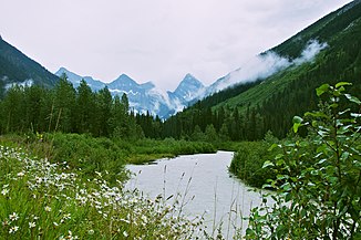
Illecillewaet River, in the background the Sir Donald Range |
||
| Data | ||
| location | British Columbia ( Canada ) | |
| River system | Columbia River | |
| Drain over | Columbia River → Pacific Ocean | |
| origin | Illecillewaet Glacier in the Selkirk Mountains 51 ° 14 ′ 37 ″ N , 117 ° 27 ′ 12 ″ W |
|
| Source height | approx. 2100 m | |
| muzzle |
Upper Arrow Lake Coordinates: 50 ° 58 ′ 56 " N , 118 ° 12 ′ 28" W 50 ° 58 ′ 56 " N , 118 ° 12 ′ 28" W. |
|
| Mouth height | 440 m | |
| Height difference | approx. 1660 m | |
| Bottom slope | approx. 23 ‰ | |
| length | 72 km | |
| Catchment area | 1230 km² | |
| Discharge at the Greeley A Eo gauge : 1150 km² Location: 10.5 km above the mouth |
MQ 1964/2015 Mq 1964/2015 |
53 m³ / s 46.1 l / (s km²) |
| Left tributaries | Albert Creek | |
| Right tributaries | Tangier River | |
| Small towns | Revelstoke | |
|
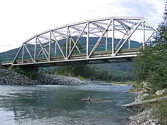
Truss steel bridge over the Illecillewaet River in Revelstoke, 2 km above the estuary |
||
The Illecillewaet River is a 72 km long river in the eastern part of the Canadian province of British Columbia .
The headwaters of the Illecillewaet River is located on the southwest flank of the Sir Donald Range in the Selkirk Mountains . There the river is fed by the Illecillewaet glacier at an altitude of about 2100 m . The Illecillewaet River flows through the mountains in a predominantly west-southwest direction. The British Columbia Highway 1 ( Trans-Canada Highway ) followed by 4 km below the glacier along the river to its mouth. The Illecillewaet River passes the small town of Revelstoke and finally flows into the upper end of the 440 m high Upper Arrow Lake . The upper 20 km of the Illecillewaet River is within Glacier National Park .
Hydrology
Since the completion of the Hugh Keenleyside Dam on the Columbia River in 1968 and its damming up to the Arrow Lakes , the Illecillewaet River no longer flows directly into the Columbia River, but into the upper end of the reservoir, the upper part of which is called Upper Arrow Lake . The catchment area of the Illecillewaet River covers an area of 1230 km². The mean discharge 10.5 km above the mouth is 53 m³ / s. The highest runoffs usually occur between May and August.
Web links
- Illecillewaet River . In: BC Geographical Names (English)
- Geographical Names of Canada: Illecillewaet River

