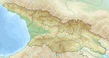
Iori highlands
Coordinates: 41 ° 24 ′ 56 ″ N , 45 ° 52 ′ 39 ″ E
The Iori highlands ( Georgian ივრის ზეგანი Iwris segani ) is a low mountain range in eastern Georgia that extends as far as Azerbaijan .
The Iori highlands extend along the Iori over a length of 170 km in WNW-OSE direction between the rivers of Kura and Alazani . The height varies between 200 and 900 m . The over 1900 m high Gombori ridge separates the plateau from the northeastern Alasani basin . The occurrence of loose sand- clay soils, sandstone and conglomerates leads to fold structures. Low mountain ranges alternate with plains and valleys. Black earth is the most common type of soil. Steppe is the predominant form of landscape. There are only sparse forest areas. Xerophytes thrive on the stony soils . The area is largely developed for agriculture. In the eastern part of the Iori highlands, the steppes of the Shiraki plain (Georgian შირაქის ვაკე Schirakis wake ) extend .
Individual evidence
- ↑ a b c Article Iori highlands in the Great Soviet Encyclopedia (BSE) , 3rd edition 1969–1978 (Russian)


