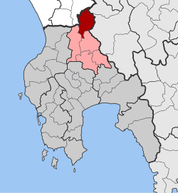
Ira (Greece)
|
Ira parish Δημοτική Ενότητα Είρας (Είρα) |
||
|---|---|---|
|
|
||
| Basic data | ||
| State : |
|
|
| Region : |
Peloponnese
|
|
| Regional District : | Messinia | |
| Municipality : | Ichalia | |
| Geographic coordinates : | 37 ° 25 ′ N , 21 ° 58 ′ E | |
| Height above d. M .: | 778 m (average) |
|
| Area : | 86.654 km² | |
| Residents : | 433 (2011) | |
| Population density : | 5 people / km² | |
| Code No .: | 440404 | |
| Structure: | 8 local communities | |
| Located in the municipality of Ichalia and in the Messenia region | ||
Ira ( Greek Είρα ( f. Sg. )) Is a municipality in the municipality of Ichalia in the Greek region of Peloponnese with 433 inhabitants. The main town and administrative seat is Neda , near which the river of the same name rises.
In the north-west of the municipality, near the border to the Elis , the temple of Apollo near Bassae is the second best preserved Greek temple in the motherland (after the Hephaisteion in Athens). It was consecrated to the god of healing Apollon Epikourios .
Individual evidence
- ↑ Results of the 2011 census, Greek Statistical Office (ΕΛ.ΣΤΑΤ) ( Memento from June 27, 2015 in the Internet Archive ) (Excel document, 2.6 MB)

