Isla Little Wellington
| Isla Little Wellington | |
|---|---|
| Waters | Pacific Ocean |
| Geographical location | 48 ° 29 ′ S , 74 ° 41 ′ W |
| length | 64 km |
| width | 43 km |
| surface | 1062.8 km² |
| Highest elevation | 1147 m |
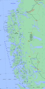
The Isla Little Wellington (also Isla Serrano called) is an island in Patagonia in southern Chile . It is located in the Pacific Ocean and with an area of 1063 km² is the fourteenth largest island in the country.
The island is located south of the Gulf of Penas in the Aysén region , the Capitán Prat province and the Tortel commune . It is part of the Wellington Archipelago , which also includes Wellington Island .
geography
Little Wellington is at the northern end of the Patagonian Canals. In the north-west it is separated from Isla Prat by the Albatross Canal , in the west by the Fallos Canal from Isla Campana and in the south by the Adalberto Canal from Isla Wellington . To the east, the larger Messier Canal separates them from Isla Cadcleugh and the Chilean mainland.
Waldemar Bay in the northern part almost divides the island into two parts (only 1.77 km of land lie in between), so that the Negro Peninsula (two-seventh of the island's area) takes up the entire north. The 64 km long east side is oriented almost in a north-south direction. Although Isla Little Wellington also has 21 inlets and fjords, it is much less indented than the other islands in the region. The Cuthbert Bay on the east side is not suitable as an anchorage, but the Heinrich Depression in the south of the island can provide anchorage within its narrow access.
Like the rest of the Andes, the island is of volcanic origin and very mountainous. The highest point is in the extreme south of the island and reaches a height of 1147 m. A very large lake in the southwest as well as many medium-sized lakes cover the island. The coastline is 339.9 km.
literature
- Instituto Geográfico Militar (1970). Atlas of the Republic of Chile Santiago - Chile - Military Geography Institute. Second edition.
- Instituto Hidrográfico de la Armada de Chile (1974). Hydrographic Atlas of Chile. Valparaíso - Chile - Hydrographic Institute of the Navy. First edition.
Web links
- Revista Mar Liga Marítima de Chile , ligamar.cl
- UCV geological oceanography , biblioteca.cl (archived)
- Topographic map of the island
