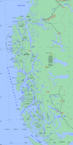
Isla Magdalena (Aysén)
| Isla Magdalena | |
|---|---|
| Waters | Pacific Ocean |
| Geographical location | 48 ° 39 ′ S , 74 ° 4 ′ W |
| length | 67 km |
| width | 62 km |
| surface | 2024.6 km² |
| Highest elevation | 1660 m |
| Residents | uninhabited |
The Isla Magdalena is an uninhabited island in Patagonia in southern Chile . It is located in the Pacific Ocean and with an area of 2025 km² is the seventh largest island in the country. Other names are Isla de Cay , Isla Desierto, and Isla de Motalat . The island is located in the Aysén region , the Capitán Prat province and the Cisnes municipality, and is part of the Chonos archipelago .
geography
Most of the island is in the Isla Magdalena National Park area . Magdalena lies in an inland bay and is separated from the mainland by the Moraleda Canal in the northeast and the Puyihuapi Canal (Puyuguapi) in the south and east, so that it is surrounded on three sides by the continent from which it separated during the last Ice Age has been. At the thinnest point, the canals are only 740 meters wide, at the thickest 10 km. In the north, the channels separate the island from its two largest minor islands, Isla Manuel and Isla Atilio. The other large offshore islands are called Isla Jesús and Isla Enrique. In the west, a large, approx. 12 km wide channel separates the island from Isla Cuptana and the smaller islands of Tránsito, Francisco and Filomena.
Isla Magdalena is approximately round in shape and is cut by six large fjords that reach far into the interior of the island (Seno Magdalena, Seno Canalad, Estero Pangal, Seno Soto and Seno Carlos are five). The island is dominated but by 1660 (according to other sources in 1676 or 1620) meters high stratovolcano Montalat (also Mentolat) just south of the center, which broke out last 1710th Its crater is filled with snow all year round. There are also many smaller lakes and two longer rivers on the island. The coastline is 435.5 km.
The nearest town is Puerto Cisnes with about 2500 inhabitants on the other side of the Puyuguapi Canal, about 10 km from the coast.
literature
- Instituto Geográfico Militar (1970). Atlas of the Republic of Chile Santiago - Chile - Military Geography Institute. Second edition.
- Instituto Hidrográfico de la Armada de Chile (1974). Hydrographic Atlas of Chile. Valparaíso - Chile - Hydrographic Institute of the Navy. First edition.
Web links
- Revista Mar Liga Marítima de Chile , ligamar.cl
- UCV geological oceanography , biblioteca.cl (archived)
Individual evidence
- ↑ Largest Islands of Chile , worldislandsinfo.com
- ↑ United States Hydrographic Office, South America Pilot (1916)
- ↑ https://mapcarta.com/20107734
- ^ South America Island High Points above 1000 meters, peakbagger.com
- ↑ Mentolat , Global Volcanism Program
- ^ Islands of Chile , United Nations Environment Program
