Jacobsen Head
| Jacobsen Head | ||
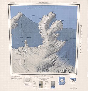
 Topographic map of the Martin Peninsula with Jacobsen Head (top right) |
||
| Geographical location | ||
|
|
||
| Coordinates | 74 ° 2 ′ S , 113 ° 35 ′ W | |
| location | Marie Byrd Land , West Antarctica | |
| coast | Walgreen coast | |
| Waters | Amundsen lake | |
The Jacobsen Head is an icy and kliff like headland at the Walgreen Coast of the West Antarctic Marie Byrd lands . It forms the northeastern end of the Slichter Foreland on the Martin Peninsula .
The United States Geological Survey first mapped the headland using aerial photographs taken by the United States Navy during Operation Highjump (1946-1947) in January 1947. The Advisory Committee on Antarctic Names named it in 1967 after Commander Glen Jacobsen (1916-1969), captain of the Icebreaker USS Atka during reconnaissance trips between 1954 and 1955 in search of locations for research stations as part of the International Geophysical Year (1957-1958).
Web links
- Jacobsen Head in the Geographic Names Information System of the United States Geological Survey (English)
- Jacobsen Head on geographic.org (English)
