Jimalalud
| Municipality of Jimalalud | ||
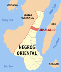
| Location of Jimalalud in the Negros Oriental Province | ||
|---|---|---|

|
||
| Basic data | ||
| Region : | Central Visayas | |
| Province : | Negros Oriental | |
| Barangays : | 28 | |
| District: | 1. District of Negros Oriental | |
| PSGC : | 074612000 | |
| Income class : | 4. Income bracket | |
| Households : | 5144 May 1, 2000 census
|
|
| Population : | 30,945 August 1, 2015 census
|
|
| Coordinates : | 9 ° 59 ′ N , 123 ° 12 ′ E | |
| Postal code : | 6212 | |
| Mayor : | Reynaldo V. Tuanda | |
| Geographical location in the Philippines | ||
|
|
||
Jimalalud is a Filipino municipality in the Negros Oriental Province . It has 30,945 inhabitants (August 1, 2015 census).
Barangays
Jimalalud is politically divided into 28 barangays .
|
|
