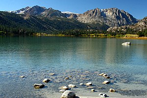
June Lake (lake)
| June Lake | ||
|---|---|---|

|
||
| June Lake | ||
| Geographical location | Mono County , California , USA | |
| Drain | Reversed Creek → Grant Lake → Rush Creek → Mono Lake | |
| Location close to the shore | June Lake | |
| Data | ||
| Coordinates | 37 ° 46 ′ 41 ″ N , 119 ° 4 ′ 28 ″ W | |
|
|
||
| Altitude above sea level | 2323 m | |
| length | 970 m | |
| width | 1.9 km | |
| Maximum depth | 51 m | |
The June Lake is a lake in Mono County of the US state of California . It is located in the east of the Sierra Nevada not far from the border with the state of Nevada in the Great Basin . June Lake is located in the highlands at 2,323 meters above sea level and is surrounded by mountains. It is one of the highest lakes in California. The body of water extends over a width of 970 meters and is around 1.9 kilometers long. The mean depth is 18 meters, while the maximum depth is 51 meters. The region is particularly popular with tourists and is also used for water sports and boat trips. In addition to two boat stations, there are also hotels and campsites on the shore . Especially in summer there is a relatively high volume of tourism. The water is also known for its more or less intense, but always striking blue color of the water, depending on the incidence of light. The nearby town of June Lake is named after the lake.

