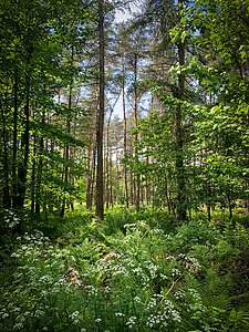
Kölln forest
|
Kölln forest
|
||
| location | North Rhine-Westphalia , Germany | |
| surface | 187.9 ha | |
| Identifier | BOT-005 | |
| WDPA ID | 164179 | |
| Geographical location | 51 ° 33 ' N , 6 ° 54' E | |
|
|
||
| Setup date | 1988 | |
The nature reserve Köllnischer Wald is located in the area of the urban district Bottrop between Alt-Bottrop and Kirchhellen in North Rhine-Westphalia .
The area extends northwest of the core city of Bottrop. On the eastern edge of the area runs the state road L 623, northeast the A 31 , south the A 2 and west the L 621. The name comes from the Cologne bishop, who owned this area centuries ago. Today the Kölln Forest is artificially kept dry (with pumps), as mining has caused the terrain to sag and the groundwater level has risen.
meaning
Since 1988, an area of around 188 hectares has been designated as a nature reserve for Bottrop under the identification number BOT-005.
See also
Web links
- Nature reserve "Köllnischer Wald (BOT-005)" in the specialist information system of the State Office for Nature, Environment and Consumer Protection in North Rhine-Westphalia


