Kınalıada
| Kınalıada | ||
|---|---|---|
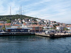
| Ferry in the port of Kınalıada | ||
| Waters | Sea of Marmara | |
| Archipelago | Prince Islands | |
| Geographical location | 40 ° 54 '47 " N , 29 ° 3' 0" E | |
|
|
||
| length | 1.6 km | |
| width | 1.5 km | |
| surface | 1.3 km² | |
| Highest elevation | Çınartepe 115 m |
|
| Residents | 3318 2552 inhabitants / km² |
|
| main place | Kınalı | |
| Kınalıada is the northernmost of the Prince Islands | ||
Kınalıada ( Greek Πρώτη Proti ) is the northernmost and the most densely populated of the Prince Islands in the Marmara Sea near Istanbul and belongs to the Adalar district . The 1.3 km², poorly forested island is 5.7 km from the Asian mainland.
The name comes from the red earth, which is typical for the island. In the past, copper and iron were mined on Kınalıada , which turned the soil red, making it the least forested island.
The island was a retreat and exile for Byzantine rulers , including Romanos IV.
The Prince's Islands, which are only twelve kilometers from the European center of Istanbul, can be reached by ferry in 25-40 minutes.
Web links
Commons : Kınalıada - collection of pictures, videos and audio files
Individual evidence
- ↑ a b c d Princes' Islands . istanbulvisions.com, 2007; accessed on January 9, 2016.


