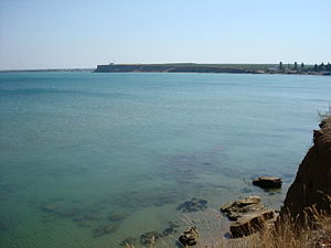
Kalamita Bay
| Kalamita Bay | ||
|---|---|---|
|
North view |
||
| Waters | Black Sea | |
| Land mass | Crimea | |
| Geographical location | 45 ° 3 ′ N , 33 ° 30 ′ E | |
|
|
||
| width | 41 km | |
| depth | 13 km | |
| Medium water depth | 30 m | |
| Tributaries | Bulganak , Alma | |
The Kalamita Bay ( Russian Каламитский залив ) is a bay in the Black Sea on the west coast of Crimea south of the city of Yevpatoria .
geography
The bay is 41 km wide and is bounded in the north by Cape Eupatoria and in the south by Cape Lukullus. The northern part of the coast to Lake Kyzyl-Yar is flat and sandy; the southern part of the bank is steeper (6–12 m) and has a loamy soil that tends to slide. The two rivers Alma and Bulganak drain into the bay, both in the southern part. In the northern part there is a series of salt water lagoons: Sasyk, Saksky, Chaika, Kyzyl-Yar and Bogayly, which are separated from the sea by narrow strips of sand. You have e.g. T. a therapeutic value due to the mineral-rich mud.
In addition to the city of Yevpatoria, there are also urban-type settlements of Zaozernoe, Nikolajewka and Novofedoriwka and the villages of Beregovoe, Peschanoe and Angular on the bay .
The ecosystem of the steep coast at the southern end of the bay, together with an adjacent strip of sea, was designated as a 125.6 hectare protection zone “The coastal aquatic complex at Cape Lukull” in order to preserve the ecologically valuable interaction in the surf as a hydrological natural monument of regional importance.
history
During the Crimean War , French and British troops landed here on September 14, 1854, to conquer the Russian base of Sevastopol . The location was chosen because a wide sandy beach makes landing easier and large parts of the bay are shielded on land by saltwater lagoons. From the seaside, the fleet of the British-French expeditionary force protected the action from attacks by Russian ships.
The translation ashore took five days, with the organization of the British troops in particular dragging on. After the departure from Varna , many sick people had to be transported, for whom wagons and carts had to be acquired in the surrounding farms. In addition, the British had bad luck with the surf, as the weather freshened the wind when the cavalry landed, which irritated the horses. The supply of drinking water was also difficult due to the brackish groundwater, especially since the British, unlike the French, only gave their soldiers 3 daily rations.
The British-French army (including a few thousand Ottomans) then moved further south, where there was a first exchange of blows with the soldiers of Tsarist Russia on the edge of the bay, on the banks of the Alma .
Individual evidence
- ↑ Orlando Figes , Crimea , Penguin, 2011, p 202ff

