Kaltenbrunn (Garmisch-Partenkirchen)
|
Kaltenbrunn
Garmisch-Partenkirchen market
Coordinates: 47 ° 29 ′ 20 ″ N , 11 ° 10 ′ 32 ″ E
|
|
|---|---|
| Height : | 858 m above sea level NHN |
| Postal code : | 82467 |
| Area code : | 08821 |
|
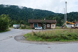
Kaltenbrunn station
|
|
Kaltenbrunn is a district of Garmisch-Partenkirchen in Upper Bavaria , which is located east of the Garmisch-Partenkirchen core area on the federal highway 2 towards Austria . Kaltenbrunn was the largest town in the municipality of Wamberg , which was incorporated into Garmisch-Partenkirchen on May 1, 1978. The Kaltenbrunn station on the Mittenwaldbahn is no longer served.
As of the last census on May 25, 1987, Kaltenbrunn had 111 inhabitants. To get around 800 m above sea level. NHN in Wettersteingebirge preferred Kaltbrunn extend Buckelwiesen and lakes: examples which may be of situated near the adjacent Gerold Wagenbrüchsee and the Barmsee called (both municipality Krün ). The agricultural area is developed for tourism and offers opportunities for recreation and sport on several cycling and hiking trails and cross-country skiing trails in summer and winter.
The part of the road near Kaltenbrunn, which is at times very accident-prone, is usually called the "Schwabenkurve", and is named after the racing driver and sports pilot Karl Schwabe , or his family. Her house was on the slope above the curve.
- Views


