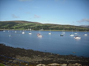
Kames Bay
| Kames Bay | ||
|---|---|---|
|
View over Kames Bay |
||
| Waters | Kyles of Bute | |
| Land mass | Isle of Bute | |
| Geographical location | 55 ° 51 '57 " N , 5 ° 4' 35" W | |
|
|
||
| width | approx. 1.8 km | |
| depth | approx. 1.2 km | |
The Kames Bay is a bay on the east coast of the Scottish island of Bute . The bay is on the Kyles of Bute Strait , which separates Bute from the Cowal Peninsula on mainland Scotland. Ardbeg Point delimits Kames Bay in the south from the neighboring Rothesay Bay . In the north it ends at Undraynian Point . The Cape Ardyne Point is located across from her at Cowal. Port Bannatyne and parts of Ardbeg are on the south coast of Kames Bay . The 1800 m wide bay cuts a maximum of 1200 m into the island.
Kames Castle and the residential tower Wester Kames Castle have been located near the head of the bay since the 16th century . These acted as the headquarters of the Bannatynes of Kames . In Port Bannatyne, two jetties were built in the 19th century, where both passenger and cargo ships could dock.
Individual evidence
- ↑ Kames Bay. In: David Munro, Bruce Gittings: Scotland. An Encyclopedia of Places & Landscapes. Collins et al., Glasgow 2006, ISBN 0-00-472466-6 .
- ↑ Entry on Kames Castle in Canmore, the database of Historic Environment Scotland (English)
- ↑ Kames. In: Francis H. Groome: Ordnance Gazetteer of Scotland: A Survey of Scottish Topography, Statistical, Biographical and Historical. Volume 4: (Har - Lib). Thomas C. Jack, Grange Publishing Works, Edinburgh et al. 1885, pp. 336-337 .
- ↑ Entry on Steamer Pier in Canmore, the database of Historic Environment Scotland (English)
- ↑ Entry on Quay in Canmore, Historic Environment Scotland's database
Web links
- Entry on Kames Bay in Canmore, Historic Environment Scotland database

