Kangshung Glacier
| Kangshung Glacier | ||
|---|---|---|
| location | Tibet ( PR China ) | |
| Mountains | Mahalangur Himal ( Himalaya ) | |
| Type | Valley glacier | |
| length | 17 km | |
| Exposure | east | |
| Altitude range | 5800 m - 4500 m | |
| width | ⌀ 1.1 km | |
| Coordinates | 27 ° 59 ′ N , 87 ° 3 ′ E | |
|
|
||
| drainage | Karma Chu → Bum Chu → Arun → Koshi | |
|
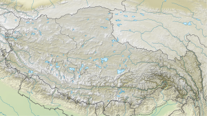
Course of the Kangshung Glacier in the Mount Everest region |
||
|
The east face (Kangshung wall) of Everest (center) and Lhotse (left), in front the Kangshung glacier |
||
The Kangshung Glacier is next to the Khumbu Glacier and the Rongpu Glacier one of the three main glaciers of Mount Everest , the areas of accumulation of which are located on the three great walls of Everest.
With a length of around 17 km, it is the longest of these three glaciers. The Kangshung Glacier is located on the east side of the highest mountain on earth in the administrative area of the city of Xigazê in the Tibet Autonomous Region of the People's Republic of China .
The common east wall of Everest and Lhotse is called the Kangshung Wall . This is where the Kangshung Glacier feeds and flows east through the Kangshung Valley. South of the glacier from the Lhotse to the east are the Pethangtse ( 6738 m ) and the Makalu massif ( 8463 m ) with its secondary peaks Makalu II ( 7678 m - also called Kangshungtse ) and the Chomo Lonzo ( 7818 m ), whose imposing north face the No view of the main summit. The border between Nepal and China runs across these peaks.
The outflow of the glacier, the Karma Chu , flows into the Arun overflow Bum Chu .
The east side of Mount Everest is the least accessible or developed side of the mountain. While the base camp on the Rongpu Glacier can be reached by off-road vehicle and fortified lodges are available for overnight accommodation on the multi-day hike to the south side of Everest, the Kangshung Glacier is most likely to be reached via a multi-day march that includes a pass crossing.


