Cape Williams
| Cape Williams | ||
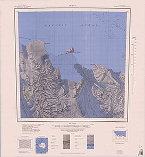
 Map of Ob 'Bay with Cape Williams (right of center) |
||
| Geographical location | ||
|
|
||
| Coordinates | 70 ° 30 ′ S , 164 ° 9 ′ E | |
| location | Victoria Land , East Antarctica | |
| coast | Pennell coast | |
| Waters | Lillie tongue and Ob 'Bay | |
| Waters 2 | Somow lake | |
The Cape Williams is an ice-covered cape at the Pennell Coast of the East Antarctic Victoria Land . It lies on the east side of the Lillie glacier tongue and limits the entrance to Ob 'Bay to the east.
Participants of the Terra Nova Expedition (1910-1913), led by the British polar explorer Robert Falcon Scott, discovered it in February 1911 on an exploration trip west of Cape North . It is named after William Williams (* 1875), the chief machinist on board the research vessel Terra Nova on this expedition.
A section of the cape, or the cape itself, is known by Russian scientists as ( Russian Мыс Ванькова Mys Wankowa , German 'Kap Wankow' ).
Web links
- Cape Williams in the Geographic Names Information System of the United States Geological Survey (English)
- Cape Williams on geographic.org (English)
Individual evidence
- ^ John Stewart: Antarctica - An Encyclopedia . Vol. 2, McFarland & Co., Jefferson and London 2011, ISBN 978-0-7864-3590-6 , p. 1632 (English).
- ↑ Van'kova, mys in the Composite Gazetteer of Antarctica (English, accessed on May 10, 2020).
