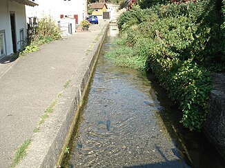
Kapellenbach (Altmuehl)
| Kapellenbach | ||
|
The Kapellenbach |
||
| Data | ||
| location | Bavaria (Germany) | |
| River system | Danube | |
| Drain over | Altmühl → Danube → Black Sea | |
| source | at the Mariahilf Chapel in Eichstätt 48 ° 53 ′ 49 ″ N , 11 ° 10 ′ 55 ″ E |
|
| Source height | 405 m above sea level NN | |
| Spring discharge |
MNQ MHQ |
150 l / s 250 l / s |
| muzzle | opposite the Stadtbahnhof in the Altmühl coordinates: 48 ° 53 '41 " N , 11 ° 10' 53" E 48 ° 53 '41 " N , 11 ° 10' 53" E |
|
| Mouth height | 385 m above sea level NN | |
| Height difference | 20 m | |
| Bottom slope | 59 ‰ | |
| length | 340 m | |
The Kapellenbach is a left tributary of the Altmühl in Eichstätt in Bavaria .
geography
Kapellenbach spring
The Kapellenbach spring is located in Eichstätt behind the Mariahilf chapel . It is a basin walled with limestone into which two karst springs flow. These emerge as stratified springs from a thicker layer of marl of the Jura marble. The source discharge is 150 to 250 liters per second. In the crystal clear water of the spring basin, the Eichstätt fishing club breeds trout , which are fished annually on Maundy Thursday .
course
The Kapellenbach flows off in two arms. The larger southern and left part used to operate several mills. The Walburgismühle building, built in 1496, is still preserved. The mill operated until 1959. Today the mill wheel is used to generate electricity. The smaller western and right arm partially flowed through the Mariahilf Chapel in an open channel and reappeared in a facade well. The Kapellenbach flows into the Altmühl after about 340 m opposite the city station .
See also
Web links
Individual evidence
- ↑ a b c Google Earth
- ↑ anglerverein-eichstaett.de


