Karthäuserberg (Marksuhl)
| Karthäuserberg (Upper and Lower) | ||
|---|---|---|
|
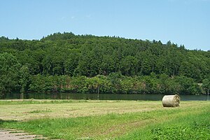
View from the lakeshore to the north to the Karthäuserberg. |
||
| height | 423.8 m above sea level NN | |
| location | Thuringia ( Germany ) | |
| Mountains | Thuringian Forest | |
| Coordinates | 50 ° 55 '22 " N , 10 ° 18' 0" E | |
|
|
||
| rock | Wartburg conglomerate | |
| particularities | Panoramic view of Wilhelmsthal Castle | |
The Karthäuserberg is a 423.8 m high mountain in Marksuhl ( Gerstungen municipality ) in the Wartburg district in Thuringia .
location
The Karthäuserberg is located above the north bank of the Wilhelmsthaler See in the Eltetal and rises north to the vicinity of the former hunting lodge Hohe Sonne on the Rennsteig of the Thuringian Forest . The mountain offers a panoramic view of the Eltegrund with the Wilhelmsthal Castle of the Dukes of Saxe-Weimar-Eisenach . The eastern boundary of the mountain forms a valley cut in which the federal road 19 runs to Eisenach, the western boundary is the "Bärenbachtal" with the side valleys of Unkengraben and Unkerodaer Hölle .
history
The Karthäuserberg was one of the possessions of the Eisenach Carthusian monastery . The monks sold the wood of the Karthäuserberg at a profit in Eisenach, the hunting rights were granted to the sovereign. With the construction of Wilhelmsthal Castle, the mountain became a destination for excursions and received a number of viewpoints. The original hut, known as the “swallow's nest”, was located directly on the edge of the rock face, while today's refuge is at a safe distance. The shady "Schupftuchswiese" located on the east side of the mountain was part of the castle park and was given the name probably because of its small size - hardly larger than a Schupftuch.
literature
- Hans Müller: Thuringia. Landscape, culture and history in the “green heart” of Germany . 2nd updated edition. DuMont, Cologne 1998, ISBN 3-7701-3848-1 , p. 85 .
- Christian Knobloch: Too beautiful to fall silent. The Wilhelmsthal palace and park . 2nd, greatly expanded and revised edition. Resch, Meiningen 2008, ISBN 978-3-940295-01-9 , pp. 117 .
Individual evidence
- ↑ Official topographic maps of Thuringia 1: 10,000. Wartburgkreis, district of Gotha, district-free city of Eisenach . In: Thuringian Land Survey Office (Hrsg.): CD-ROM series Top10 . CD 2. Erfurt 1999.
- ^ Heinz Rosenkranz: On the history of the settlements in the Elte river basin. Manuscript, without location, without year, Oberellen local file in the Thuringian Museum Eisenach.

