Karun-4
| Karun-4 | |||||
|---|---|---|---|---|---|
|
|||||
|
|
|||||
| Coordinates | 31 ° 36 '0 " N , 50 ° 28' 11" E | ||||
| Data on the structure | |||||
| Construction time: | 1993-2011 | ||||
| Height above valley floor: | 222 m | ||||
| Height above foundation level : | 230 m | ||||
| Building volume: | 1.8 million m³ | ||||
| Crown length: | 440 m | ||||
| Crown width: | 7 m | ||||
| Power plant output: | 1000 MW | ||||
| Data on the reservoir | |||||
| Storage space | 2190 million m³ | ||||
| Design flood : | 8600 m³ / s | ||||
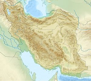
Karun-4 is a dam with a hydroelectric power station on the Karun River in Iran . It is located 180 km southwest of Shahr-e Kord in the province of Tschahār Mahāl and Bachtiyāri .
The dam has a double-curved arch dam made of concrete as a barrier structure. The dam is 230 meters high, 440 m long, 7 m wide at the top and 35 m wide at the bottom. Concrete work on the dam, which is currently under construction, began on February 5, 2006. It will be the largest in Iran.
The reservoir holds 2190 million cubic meters of water, 749 million of which are usable operating space. From 2008 it should be filled. With the flood relief , 8600 m³ / s can be discharged.
The hydropower plant has an output of 1000 megawatts . These are supplied by four machine sets of 250 MW each. Every year, 2107 million kilowatt hours of energy worth up to 100 million dollars are to be generated from hydropower . Two 615 and 637 m long tunnels with a diameter of 9.5 m were built to supply the power plant.
In addition, the lower reaches of the Karun are protected from high water , raised when the water is low and irrigation is enabled. On the Karun there are also the power plants Karun-1 to Karun-3 .
See also
- List of the largest dams on earth
- List of the largest reservoirs on earth
- List of the largest hydroelectric plants in the world
- List of power plants in Iran
- List of dams in the world (Iran)
Web links
- Iran Soil & Water Engineering Site Iran Dams Karun 4
- official Iranian website (Persian)
- Karun 4 Dam and Power Plant (English)
- Karun 4 Dam and Power Plant with photos and dates (Persian)

