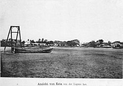
Keta
| Keta | ||
|---|---|---|
|
|
||
| Coordinates | 5 ° 55 '19 " N , 0 ° 59' 34" E | |
| Basic data | ||
| Country | Ghana | |
| Volta region | ||
| ISO 3166-2 | GH-TV | |
| height | 5 m | |
| surface | 10 km² | |
| Residents | 22,000 | |
| density | 2200 Ew. / km² | |
Keta ( Ewe : "Sandkopf"), English also Quitta , is a city in the Volta Region on the coast of Ghana and the capital of the Keta District (Keta Municipal).
Location and history
Keta lies on a narrow, constantly threatened by erosion spit , which separates the Keta Lagoon from the Gulf of Guinea ( Atlantic Ocean ). Before the arrival of the Europeans in the 15th century, it was a market town of local importance in the Kingdom of Anlo. The development of the trading center, which is important for the population of the Volta region, was decisively influenced by European colonial interests from the beginning of the 18th century. To protect their own trading bases , the Dutch built Fort Singelenburgh in 1734 , and the Danes built Fort Prinzenstein at the same location in 1784 . After being taken over by England in 1850, Keta increasingly lost its national importance. The gently sloping seabed prevented larger ships from docking, so that all goods and people had to be transported through the surf from and to the ships lying in the roadstead .
Since the year 2000, attempts have been made to stop the further destruction of Ketas by sea erosion by means of cost-intensive coastal protection structures (Keta sea defense project).
See also
literature
- Christian Hornberger : The Ewe area on the slave coast of West Africa . In: Petermanns Geographische Mitteilungen 13, 1867, p. 48ff.
- Johann Karl Vietor : Historical and cultural development of our protected areas. Dietrich Reimer Verlag. Berlin 1913, p. 9.
- August Wilhelm Schreiber: Building blocks for the history of NMG. In: 150 Years of the North German Mission. Bremen 1986, pp. 84-96
Web links
- http://keta.ghanadistricts.gov.gh/ (English)

