Kiso Mountains
| Kiso Mountains | ||
|---|---|---|
|
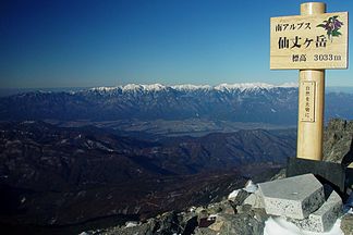
Kiso Mountains from Senjō-ga-take |
||
| Highest peak | Kiso-Komagatake ( 2956 m ) | |
| location | Nagano Prefecture , Japan | |
| part of | Japanese Alps | |
|
|
||
| Coordinates | 35 ° 47 ' N , 137 ° 48' E | |
The Kiso Mountains ( Japanese 木 曽 山脈 , Kiso-sanmyaku ), also called Japanese "Central Alps" ( 中央 ア ル プ ス , Chūō Arupusu for English Alps ), is a mountain range in Nagano Prefecture in Japan . Together with the Hida Mountains (Northern Alps) and the Akaishi Mountains (Southern Alps), it forms the Japanese Alps . The mountain range lies between the Kiso rivers in the west and Tenryū in the east, both of which flow into the Pacific Ocean . The mountain range is outGranite built up.
mountains
| image | mountain |
Height (m) |
comment |
|---|---|---|---|

|
Kyogatake | 2296 m | |
|
|
Kiso Komagatake | 2956 m | the highest mountain in the Kiso Mountains |

|
Hōkendake | 2931 m | Senjōjiki- Kar |

|
Sannosawadake | 2846 m | |

|
Utsugidake | 2864 m | |

|
Minami Komagatake | 2841 m | |

|
Kosumoyama | 2613 m | |

|
Enclosed jiyama | 2363 m | |
|
|
Ena | 2191 m |
See also
Web links
Commons : Kiso Mountains - collection of pictures, videos and audio files


