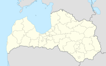
Kocēni
| Kocēni ( German : Kokenhof) | ||
|---|---|---|
 Help on coat of arms |
|
|
| Basic data | ||
| State : |
|
|
| Landscape: | Vidzeme ( Latvian : Vidzeme ) | |
| Administrative district : | Kocēnu novads | |
| Coordinates : | 57 ° 31 ' N , 25 ° 20' E | |
| Residents : | 1,034 (Jun 3, 2015) | |
| Area : | ||
| Population density : | ||
| Height : | 60 m | |
| Website: | www.kocenunovads.lv | |
| Post Code: | ||
| ISO code: | ||
| Former Kokenhof manor house, now elementary school | ||
Kocēni (German: Kokenhof ) is a village in northern Latvia , 5 km west-southwest of Valmiera .
history
The place developed around the manor Kokenhof. From 1763 to 1846 the village and the manor belonged to the Anhorn von Hartwiss family. A beer brewery existed since 1857 . In 1938 a municipal administration was set up with the neighboring Duckershof.
Today there is a primary school, a cultural center, a pharmacy, a sports club and horse breeding in Kocēni.
Kocēnu novads
The Kocēnu Novads administrative district was established in 2009 from the municipalities of Bērzaine, Dikļi, Vaidava, Zilākalns and Kocēni. The administration is located in Kocēni. At first, the district was still called Valmieras novads. (See also: Administrative division of Latvia )
In 2010, 7018 inhabitants were registered. In the district is the Zilaiskalns (German: Blue Hill), with 126.6 meters the highest point in northwest Livonia.
literature
- Hans Feldmann , Heinz von zur Mühlen (ed.): Baltic historical local dictionary, part 2: Latvia (southern Livonia and Courland). Böhlau, Cologne 1990, ISBN 3-412-06889-6 , p. 292.
- Astrīda Iltnere (ed.): Latvijas Pagasti, Enciklopēdija. Preses Nams, Riga 2002, ISBN 9984-00-436-8 .

