Krossá (Rangárvallasýsla)
| Krossá | ||
|
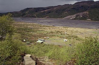
View over the Krossá plain to Markarfljót |
||
| Data | ||
| location | Southurland ( Iceland ) | |
| River system | Markarfljót | |
| Drain over | Markarfljót → Atlantic | |
| source | Krossárjökull / Mýrdalsjökull 63 ° 59 ′ 32 ″ N , 19 ° 59 ′ 7 ″ W. |
|
| muzzle | in the Markarfljót coordinates: 63 ° 41 ′ 17 ″ N , 19 ° 36 ′ 31 ″ W 63 ° 41 ′ 17 ″ N , 19 ° 36 ′ 31 ″ W.
|
|
| length | 41 km | |
|
The river seen from the Básar hut |
||
The Krossá is a tributary of the Markarfljót in southern Iceland .
geography
The Krossá rises in the Krossárjökull glacier , an arm of the Mýrdalsjökull . The river then flows between the Eyjafjallajökull glacier and the Þórsmörk and finally flows into the Markarfljót. Below the Valahnjúkur there is a 41 meter long pedestrian bridge.
The river is notorious because its water level can change very quickly.
traffic
On the way to the Þórsmörk , the river has to be crossed several times by car or bus.
See also
Web links
Commons : Krossá - collection of images, videos and audio files
- Photo Krossá, Thórsmörk
- Water level Krossá, IMO (isl., Hæð = water level, rennsli = amount of water, leiðni = conductivity)
Individual evidence
- ↑ Íslandshandbókin. Náttúra, saga og sérkenni. 2. bindi. Edited by T. Einarsson, H. Magnússon. Örn og Örlygur, Reykjavík 1989, p. 750

