Markarfljót
| Markarfljót | ||
|
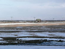
Upper Markarfljót with the Myrdalsjökull glacier, left. View from north to south |
||
| Data | ||
| location | Iceland | |
| River system | Markarfljót | |
| source |
Rauðafossafjöll 63 ° 57 ′ 5 ″ N , 19 ° 21 ′ 31 ″ W. |
|
| muzzle |
Atlantic Ocean Coordinates: 63 ° 32 ′ 20 " N , 20 ° 1 ′ 20" W 63 ° 32 ′ 20 " N , 20 ° 1 ′ 20" W |
|
| Mouth height |
0 m
|
|
| length | 100 km | |
| Left tributaries | Krossá | |
The Markarfljót is a river in southern Iceland .
The length of the river is about 100 km. The highest amount of water that was measured in it at one time was 2100 m³ / s during the Steinholt Glacier Run in 1967.
Upper course
It rises in the Rauðufossafjöll massif , east of the Hekla . It flows through narrow gorges in the mountainous region between Tindfjallajökull and Torfajökull until it emerges on the wide Sandur plain of the southern region near the Þórsmörk .
Further course
The river is already of considerable size when it flows out of the Emstrur . Its bed runs first north, then west of the Þórsmörk, and it finally flows west of the Eyjafjallajökull into the Atlantic .
Cumulative flow
It is a collective flow .
The waters of its tributaries come mainly from the Mýrdalsjökull and Eyjafjallajökull glaciers .
One of its tributaries is the Krossá , which flows through the Þórsmörk and is known and notorious for its unpredictability.
See also
Web links


