Kultsjön
| Kultsjön | ||
|---|---|---|

|
||
| View of Kultsjön from Middagskullen in Saxnäs | ||
| Geographical location | Lapland , Sweden | |
| Tributaries | Ångermanälven , Saxån | |
| Drain | Ångermanälven | |
| Location close to the shore | Vilhelmina | |
| Data | ||
| Coordinates | 65 ° 2 ' N , 15 ° 9' E | |
|
|
||
| Altitude above sea level | 542.4 m above sea level | |
| surface | 53.4 km² | |
| length | 30 km | |
| width | 3 km | |
| volume | 1.177 km³ | |
| Maximum depth | 129.8 m | |
| Middle deep | 21.3 m | |
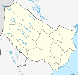
The Kultsjön ( South Sami : Gåaltoe ) is located in the municipality of Vilhelmina in Västerbotten County in the Swedish historical province of Lapland west of Vilhelmina . At an altitude of 542.4 m above sea level. located lake is 53.4 km² and has a maximum depth of 129.8 meters. The Ångermanälven , Sweden's most water-rich river, flows through the lake . The lake is used to generate electrical energy, which means that the water level can drop to 537 meters above sea level.
The lake, which is around 30 long and 3 km wide, stretches from Klimpfjäll , where the Saxån coming from Stekenjokk flows, over a narrow point crossed by a road bridge on the wilderness road (Vildmarksvägen), behind which a bay from the Sami church at Fatmomakke flows into the the Ångermanälven, coming from the lake Ransarn , flows into it until below Saxnäs . The Vildmarksväg runs along the lakeshore.
Web links
Individual evidence
- ↑ Kultsjön in the Vatten information system Sverige
- ↑ a b Sverige vägatlas. Norstedts, Stockholm, 2014. ISBN 978-91-1305683-8
- ↑ a b c Sjödjup och sjövolym (712.6 kB; PDF) , Svenskt vattenarkiv (SVAR), Sveriges meteorologiska och hydrologiska institut (Swedish)

