Cure (Tunguska)
|
Kur Кур |
||
|
|
||
| Data | ||
| Water code | RU : 20030900112118100066423 | |
| location | Khabarovsk region ( Russia ) | |
| River system | Amur | |
| Drain over | Tunguska → Amur → Tatar Sound | |
| source |
Mjaochan Mountains 50 ° 29 ′ 46 ″ N , 136 ° 10 ′ 38 ″ E |
|
| confluence | with Urmi to the Tunguska coordinates: 48 ° 43 '49 " N , 134 ° 16' 59" E 48 ° 43 '49 " N , 134 ° 16' 59" E
|
|
| length | 434 km | |
| Catchment area | 13,700 km² | |
| Left tributaries | Alg | |
| Right tributaries | Jarap, Birakan, Ulika | |
|
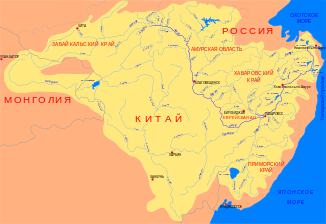
Location of the cure (Кур) in the catchment area of the Amur |
||
The Kur ( Russian Кур ) is the left headwaters of the Amur tributary Tunguska in the Khabarovsk region in the Far East of Russia .
The 434 km long river has its origin in the Mjaochan Mountains west of Komsomolsk on the Amur . From there it flows in a south-westerly direction. Finally, it joins the Urmi River to the Tunguska on the border with the Jewish Autonomous Oblast . The cure drains an area with an area of 13700 km². In summer the river overflows its banks when the water is high.
Web links
- Реки Хабаровского края. Кур
- Река Кур. Хабаровский край
- Государственный водный реестр РФ: Кур (Олгон) . Archived from the original on August 17, 2012. Retrieved September 25, 2013.
