Tunguska (Amur)
|
Tunguska Тунгуска |
||
|
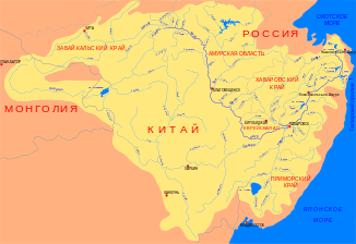
Location of the Tunguska (Тунгуска) in the catchment area of the Amur |
||
| Data | ||
| Water code | RU : 20030900112118100064931 | |
| location | Khabarovsk Region , Jewish Autonomous Oblast ( Russia ) | |
| River system | Amur | |
| Drain over | Amur → Tatar Sound | |
| origin | Confluence of the Kur and Urmi rivers 48 ° 43 ′ 59 ″ N , 134 ° 17 ′ 2 ″ E |
|
| Source height | approx. 39 m above sea level Baltic Sea | |
| muzzle | near Khabarovsk in the Amur coordinates: 48 ° 37 '8 " N , 134 ° 59' 59" E 48 ° 37 '8 " N , 134 ° 59' 59" E |
|
| Mouth height | approx. 29 m above sea level Baltic Sea | |
| Height difference | approx. 10 m | |
| Bottom slope | approx. 0.12 ‰ | |
| length | 86 km | |
| Catchment area | 30,200 km² | |
| Outflow location: 37 km above the mouth |
MQ |
380 m³ / s |
| Small towns | Nikolaevka | |
| Navigable | whole length | |
The Tunguska ( Russian Тунгуска ) is an 86 km long left or northern tributary of the Amur in the East Siberian Far East of Russia ( Asia ).
It is not to be confused with the tributaries of the Yenisei in Central Siberia , Lower , Stony (also Middle) and Dry Tunguska and Angara (in the lower reaches also called "Upper Tunguska" in the past).
course
The entire length of the Tunguska runs along the border between the Khabarovsk region and the Jewish Autonomous Oblast . It arises at a height of about 39 m from the source rivers Kur (length 434 km) from the left and Urmi (458 km) from the right. The river, fed by numerous smaller tributaries, meanders in an easterly direction through the marshy Lower Amur lowlands . A few kilometers north-northwest of Khabarovsk (capital of the Khabarovsk region) the Tunguska flows into the Amur at around 29 m above sea level, which reaches the Tatar Sound ( Pacific ) 950 kilometers further northeast .
Hydrography
The catchment area of the Tunguska covers 30,200 km². The river is 200 to 400 m wide and up to 6 m deep; the flow velocity is 0.6 m / s. The mean water flow in the middle course, 37 km above the mouth, is 380 m³ / s, with a minimum of only 7.25 m³ / s and a maximum of 5,100 m³ / s. The Tunguska is covered by ice from November to April every year .
Economy and Infrastructure
The Tunguska, like the source river Kur, is navigable for a further 117 km along its entire length.
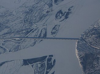
The Trans-Siberian Railway runs parallel to the Tunguska, 6 to 15 km from the right bank . At Wolotschajewka Wtoraja , the railway line to Komsomolsk-on-Amur , which was opened in 1938 and crosses the river on a 400 m long bridge, branches off from this . The M58 Amur road also runs along the Transsib .
The largest villages on or near the Tunguska are Volotschajewka Wtoraja and Volotschajewka Pervaya , Danilowka and a few kilometers downstream Nikolayevka . An agricultural area extends around these villages to the right (south) of the Tunguska.
Web links
Individual evidence
- ↑ a b Article Tunguska in the Great Soviet Encyclopedia (BSE) , 3rd edition 1969–1978 (Russian)
- ↑ a b c d e Tunguska in the State Water Register of the Russian Federation (Russian)
- ↑ List of Inland Waterways of the Russian Federation (confirmed by Order No. 1800 of the Government of the Russian Federation of December 19, 2002)


