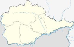
Volochayevka Vtoraya
| Urban-type settlement
Volochayevka Vtoraya
Волочаевка Вторая
|
||||||||||||||||||||||||||||||
|
||||||||||||||||||||||||||||||
|
||||||||||||||||||||||||||||||
Wolotschajewka Wtoraja ( Russian Волоча́евка Втора́я ; also Volotschajewka-2 ) is an urban-type settlement in the Jewish Autonomous Oblast ( Russia ) with 1937 inhabitants (as of October 14, 2010).
geography
The settlement is in the Amurniederung , a few kilometers from the right bank of the Amur -Nebenflusses Tunguska removed. It is located about 125 km as the crow flies east of the republic capital Birobidzhan , belongs to the Smidowitsch Rajon and is a good 50 km to the east from its administrative center Smidowitsch . The village of Sozgorodok, 3 km to the north, also belongs to the municipality (gorodskoje posselenije) Volotschajewka.
history
The place was created from 1936 in connection with the construction of the Wolotschajewka – Dzemgi railway line , when a larger connecting station to the Trans-Siberian Railway was built there. With the opening of the line in 1938, it received the status of an urban-type settlement and its name after the older village of Volotschajewka about 7 km to the east with the addition of Wtoraya ('second'). The village was renamed Volotschajewka Pervaya ('First Volotschajewka').
Population development
| year | Residents |
|---|---|
| 1939 | 912 |
| 1959 | 1981 |
| 1970 | 1766 |
| 1979 | 1783 |
| 1989 | 2060 |
| 2002 | 2035 |
| 2010 | 1937 |
Note: census data
Economy and Infrastructure
In Volotschajewka Wtoraja there is the large station Volotschajewka II , the starting point of the railway line Volotschajewka-Dzemgi, which connects the Trans-Siberian Railway with the Baikal-Amur mainline near Komsomolsk on the Amur . To the south of Volotschajewka II (route kilometer 9) there are two connecting curves to the Transsib to the east ( Nikolayevka ) and west (Wolotschajewka I) ; up to Volotschajewka II these are electrified in contrast to the further route to Dzemgi . The train station is the most important economic factor for the place.
To the south, the settlement along the Trans-Siberian is bypassed by the M 58 Amur road from Chita to Khabarovsk, part of the transcontinental road connection.
Individual evidence
- ↑ a b Itogi Vserossijskoj perepisi naselenija 2010 goda. Tom 1. Čislennostʹ i razmeščenie naselenija (Results of the All-Russian Census 2010. Volume 1. Number and distribution of the population). Tables 5 , pp. 12-209; 11 , pp. 312–979 (download from the website of the Federal Service for State Statistics of the Russian Federation)
- ↑ Article Volotschajewka Wtoraja in the Great Soviet Encyclopedia (BSE) , 3rd edition 1969–1978 (Russian)

