Chingansk
| Urban-type settlement
Chingansk
Chingansk
|
||||||||||||||||||||||||||||
|
||||||||||||||||||||||||||||
|
||||||||||||||||||||||||||||
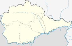
Chingansk ( Russian Хинга́нск ) is an urban-type settlement in the Jewish Autonomous Oblast ( Russia ) with 1,459 inhabitants (as of October 14, 2010).
geography
The settlement is located in the Small Hinggan Mountains, mainly on the left headstream of the Amur tributary Chingan , the Left Chingan (Lewy Chingan). In the vicinity of the place, the wooded low mountain range in the summit rises to a height of about 800 m . The main ridge of the mountains, which forms the watershed between the Amur tributaries Chingan and Bira , runs east of the settlement, the border to the Khabarovsk region on another ridge a little northwest.
Chingansk is about 130 km as the crow flies west-northwest of the republic capital Birobidzhan . The settlement belongs to the Obblutschje Rajon and is a good 15 km northeast of its administrative center Obluchye . The village of Solovyovka also belongs to the municipality (gorodskoje posselenije) Chingansk.
history
The place was created in connection with the discovery of a tin ore deposit in 1944. A mine was built by 1948; in the same year the place received the status of an urban-type settlement.
Population development
| year | Residents |
|---|---|
| 1959 | 4364 |
| 1970 | 3417 |
| 1979 | 2852 |
| 1989 | 3157 |
| 2002 | 2161 |
| 2010 | 1459 |
Note: census data
Economy and Infrastructure
The place-building company was the Chinganolowo tin mine ('Chingan tin') with an enrichment factory. The cassiterite ore was initially extracted in open-cast mining , soon also underground , from 1964 exclusively underground to a depth of 600 m. In 2005/2006, after privatization in 1999 and the gradual shutdown of production due to unprofitability, the plant was finally closed, and part of the equipment was sold as scrap. It is hoped in the settlement that a seismological station will be built in the future, that building materials will be removed from the mine dumps and that the site will be transformed into a residential area for employees in the Obbluchye district, where living space is relatively scarce.
Chingansk is connected to the Obbluchye district center by a 20 km long road running through the valley of the Chingan River. There is a connection to the Trans-Siberian Railway and the M 58 Amur trunk road from Chita to Khabarovsk, part of the transcontinental road connection.
Individual evidence
- ↑ a b Itogi Vserossijskoj perepisi naselenija 2010 goda. Tom 1. Čislennostʹ i razmeščenie naselenija (Results of the All-Russian Census 2010. Volume 1. Number and distribution of the population). Tables 5 , pp. 12-209; 11 , pp. 312–979 (download from the website of the Federal Service for State Statistics of the Russian Federation)
- ↑ Chinganolowo in the Gornaja enziklopedija ( mining encyclopedia ; Russian)
- ↑ Article in the Birobidschaner weekly newspaper Die Woch . No. 40, 2010 (Russian)

