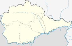
Izwestkowy (Jewish Autonomous Oblast)
| Urban-type settlement
Iswestkowy
Известковый
|
||||||||||||||||||||||||||||||||
|
||||||||||||||||||||||||||||||||
|
||||||||||||||||||||||||||||||||
Iswestkowy ( Russian Известко́вый ) is an urban-type settlement in the Jewish Autonomous Oblast ( Russia ) with 1809 inhabitants (as of October 14, 2010).
geography
The place is in the Small Hinggan Mountains , a low mountain range that continues over the almost 100 kilometers southwest flowing Amur into the People's Republic of China , not far from the right bank of the river Kuldur and the river Kimkan, which flows into it, a little above the junction of the Kuldur the Sutara to the left Amur tributary Bira . To the west of the settlement, the mountains rise to a height of a good 500 m .
Iswestkowy belongs to the Oblastkowy Rajons and is located almost 40 kilometers as the crow flies east of its administrative center Obluchye and 100 kilometers west-northwest of the Oblast capital Birobidzhan . The municipality (Gorodskoje posselenije) Izwestkowy also includes the five surrounding villages Abramowka (5 km west), Dwuretschje (3 km south-east), Kimkan (10 km west), Rudnoe (6 km north) and Snarsk (3 km west).
history
The place was created in 1913 in connection with the construction of the Amur Railway from Kuenga to Khabarovsk, the last section of the Trans-Siberian Railway on the territory of the Russian Empire , when the construction of a station began there. The section went into operation in 1915. The station and the associated settlement were named after the limestone rocks that emerged in the area (Russian iswest for lime ). In 1948 the place received the status of an urban-type settlement.
Population development
| year | Residents |
|---|---|
| 1959 | 6753 |
| 1970 | 4662 |
| 1979 | 3625 |
| 1989 | 3025 |
| 2002 | 2229 |
| 2010 | 1809 |
Note : 1959-2010 census data
Economy and Infrastructure
The Izwestkowaja station of the Trans-Siberian Railway is located in Izwestkowy (route km 8234 from Moscow ). There, a 356-kilometer cross-connection branches off to Novy Urgal on the Baikal-Amur Mainline (BAM) and on to the Tschegdomyn mining center . The location on the railway lines is the most important economic factor.
To the south, the M 58 Amur road from Chita to Khabarovsk bypasses the settlement , part of the transcontinental road connection.
Individual evidence
- ↑ a b Itogi Vserossijskoj perepisi naselenija 2010 goda. Tom 1. Čislennostʹ i razmeščenie naselenija (Results of the All-Russian Census 2010. Volume 1. Number and distribution of the population). Tables 5 , pp. 12-209; 11 , pp. 312–979 (download from the website of the Federal Service for State Statistics of the Russian Federation)
- ↑ History of the Rajon on the official website (Russian)

