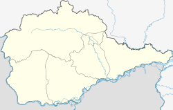
Teploosjorsk
| Urban-type settlement
Teploosjorsk
Теплоозёрск
|
||||||||||||||||||||||||||||||
|
||||||||||||||||||||||||||||||
|
||||||||||||||||||||||||||||||
Teploosjorsk ( Russian Теплоозёрск ) is an urban-type settlement in the Jewish Autonomous Oblast ( Russia ) with 4,311 inhabitants (as of October 14, 2010).
geography
The settlement is located in the Little Hinggan Mountains on the left bank of the Amur tributary Bira , about 80 km as the crow flies west-northwest of the republic capital Birobidzhan .
Teploosjorsk belongs to Rajon Obluchye and is the administrative center Obluchye away about 60km to the east.
history
The place was created in the 1920s in connection with the establishment of a fish farm on a lake connected to the Bira, which does not freeze in winter, which is why it is called Tjoploje osero ('warm lake') . The lake gave the settlement its name. Later a cement works was built based on the same limestone deposits as the limestone works in neighboring Londoko to the east . In 1958, Teploosjorsk received urban-type settlement status.
Population development
| year | Residents |
|---|---|
| 1959 | 7504 |
| 1970 | 6562 |
| 1979 | 6485 |
| 1989 | 5775 |
| 2002 | 5124 |
| 2010 | 4311 |
Note: census data
Economy and Infrastructure
The building company is the cement works east of the town. There is also a new Chinese- owned wood processing plant .
The Tjoploje Osero station of the Trans-Siberian Railway is located in Teploosjorsk (route km 8260 from Moscow ). To the north, the settlement is bypassed by the new route of the M 58 Amur trunk road from Chita to Khabarovsk , part of the transcontinental road connection.
Individual evidence
- ↑ a b Itogi Vserossijskoj perepisi naselenija 2010 goda. Tom 1. Čislennostʹ i razmeščenie naselenija (Results of the All-Russian Census 2010. Volume 1. Number and distribution of the population). Tables 5 , pp. 12-209; 11 , pp. 312–979 (download from the website of the Federal Service for State Statistics of the Russian Federation)
- ↑ Information on Obbluchye Raion (Russian)

