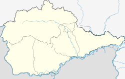
Amurset
| Village
Amurzet
Амурзет
|
||||||||||||||||||||||||||||||||
|
||||||||||||||||||||||||||||||||
|
||||||||||||||||||||||||||||||||
Amurset ( Russian Амурзе́т ) is a village (selo) in the Jewish Autonomous Oblast in Russia with 5051 inhabitants (as of October 14, 2010).
geography
The place is about 180 km as the crow flies southwest of the Oblast administrative center Birobidzhan in the Amur lowlands , a little below (southeast) the breakthrough of the Amur through the Small Hinggan Mountains . It is located on the left bank of the river, which is about one kilometer wide and marks the border with the People's Republic of China , opposite the village ( large community ) Mingshan ( 名 山镇 ) in Luobei County .
Amurzet is the administrative center of the Rajons Oktyabrsky and seat the rural community Amursetskoje selskoje posselenije, which also includes the villages Jekaterino-Nikolskoe (km 11 northwest), Osjornoje (7 km north-northeast), Pompejewka (75 km north-northwest), Pusino (10 km northeast) and Sojusnoje (27 km north-northwest) belong.
history
The village was founded in 1928 by Jewish resettlers . The name is a portmanteau of the Amur and the abbreviation set for s emelnoje (j) e wreiskoje t owarischtschestwo, Russian for "Jewish land Cooperative". With the establishment of the Jewish National Oblast and its division into rajons on July 20, 1934, the village became part of the Stalinski rajon (after Josef Stalin ) with its seat in Stalinsk (until 1928 Butylkino , until 1934 Stalinfeld, badly destroyed by floods in 1951, renamed in 1962 Oktyabrskoje and abandoned in 1968).
Before 1940 the administrative headquarters were relocated to Amurset, where the largest collective farm in the area, called Red October, was now located. The Rajon was renamed Amurski in 1961 , on February 1, 1963 in Oktjabrski rajon (from Russian oktjabr for "October" with reference to the October Revolution ) and at the same time reduced in size.
Population development
| year | Residents |
|---|---|
| 1939 | 1227 |
| 1959 | 2792 |
| 1970 | 4189 |
| 1979 | 5172 |
| 1989 | 6243 |
| 2002 | 5382 |
| 2010 | 5051 |
Note: census data
traffic
Regional road 99K-1 (formerly R456 from Birofeld ) leads to Amurset and branches off from 99K-2 Birobidschan - Leninskoje a good 100 km northeast near Ungun not far from Babstowo . The nearest train station is also in Ungun, at kilometer 84 of the route that also connects Birobidzhan with Leninskoye. In Birobidzhan there is a connection to the Trans-Siberian Railway and the federal trunk road R297 Amur (formerly M58) Chita - Khabarovsk .
In Amurset there is a road border crossing into the People's Republic of China; the Amur is crossed there by a car ferry .
Web links
Individual evidence
- ↑ a b Itogi Vserossijskoj perepisi naselenija 2010 goda. Tom 1. Čislennostʹ i razmeščenie naselenija (Results of the All-Russian Census 2010. Volume 1. Number and distribution of the population). Tables 5 , pp. 12-209; 11 , pp. 312–979 (download from the website of the Federal Service for State Statistics of the Russian Federation)
- ↑ "Renaming the hamlet of Butylkino in the village of Stalinfeld ..." in Birodischanskaja Swesda ( Birobidschaner Schtern ) from August 1, 2012 (Russian)

