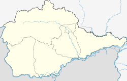
Kuldur
| Urban-type settlement
Kuldur
Кульдур
|
||||||||||||||||||||||||||||||
|
||||||||||||||||||||||||||||||
|
||||||||||||||||||||||||||||||
Kuldur ( Russian Кульду́р ) is an urban-type settlement in the Jewish Autonomous Oblast ( Russia ) with 1609 inhabitants (as of October 14, 2010).
geography
The settlement is located in the Small Hinggan Mountains, mainly on the left bank of the Kuldur river of the same name, the left source of the Amur tributary Bira . Immediately north of the settlement, the main ridge of the low mountain range rises to a height of almost 1000 m . There it marks the border with the Khabarovsk region .
Kuldur is located about 105 km as the crow flies west-northwest of the republic capital Birobidzhan . It belongs to the Obblutschje Rajon and is about 50 km east-northeast from its administrative center Obblutschje .
history
The place emerged from 1924 as one of the first balneological health resorts in the Far East of Russia, based on the 72 ° C warm mineral waters known there since the second half of the 19th century, which were first geologically examined in 1910. The name is derived from the word chulschiur , which means 'hot water' in the Nanai language . In 1929 the first sanatorium started operating. In 1958, Kuldur received urban-type settlement status.
Population development
| year | Residents |
|---|---|
| 1939 | 2149 |
| 1959 | 2367 |
| 1970 | 3173 |
| 1979 | 3127 |
| 1989 | 4132 |
| 2002 | 1957 |
| 2010 | 1609 |
Note: census data
Economy and Infrastructure
Kuldur is a health resort of regional importance with several sanatoriums. The place is on the Izvestkowaja - Tschegdomyn railway line , which connects the Trans-Siberian Railway with the Baikal-Amur Mainline (BAM) near Novy Urgal (route km 30). Road connection exists to Birakan, 23 km to the south, on the M 58 Amur road from Chita to Khabarovsk , part of the transcontinental road connection.
Individual evidence
- ↑ a b Itogi Vserossijskoj perepisi naselenija 2010 goda. Tom 1. Čislennostʹ i razmeščenie naselenija (Results of the All-Russian Census 2010. Volume 1. Number and distribution of the population). Tables 5 , pp. 12-209; 11 , pp. 312–979 (download from the website of the Federal Service for State Statistics of the Russian Federation)
- ↑ Kuldur on the AquaExpert website (Russian)

