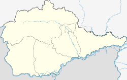
Birakan
| Urban-type settlement
Birakan
Биракан
|
||||||||||||||||||||||||||||||
|
||||||||||||||||||||||||||||||
|
||||||||||||||||||||||||||||||
Birakan ( Russian Бирака́н ) is an urban-type settlement in the Jewish Autonomous Oblast ( Russia ) with 2151 inhabitants (as of October 14, 2010).
geography
The settlement is located in the Small Hinggan Mountains on the left bank of the Amur tributary Bira, a little below its origin from Sutara and Kuldur, and above the confluence of the small tributary Birakan. To the south of the settlement, the Sutara ridge of the low mountain range rises to a height of almost 800 m .
Birakan is about 90 km as the crow flies west-northwest of the republic capital Birobidzhan . It belongs to Rajon Obluchye and is the administrative center Obluchye about 50 km to the east. The two nearby villages of Novoje and Tjoplyje Klyuchi also belong to the municipality (gorodskoje posselenije) Birakan.
history
The place was founded in 1905 and named after the nearby river that flows into the Bira (the name stands in Evenk for ' little river' ). A little later, the Amur railway from Kuenga to Khabarovsk passed the site and started operating on this section in 1915. In 1931 Birakan received urban-type settlement status.
Population development
| year | Residents |
|---|---|
| 1939 | 4360 |
| 1959 | 4288 |
| 1970 | 3023 |
| 1979 | 3081 |
| 1989 | 3089 |
| 2002 | 2543 |
| 2010 | 2151 |
Note: census data
Economy and Infrastructure
Not far from Birakan, a valley deposit was discovered that has not yet been mined. The Rajon Hospital is located in the village.
Birakan is a station of the Trans-Siberian Railway (route km 8248 from Moscow ). To the north, the M 58 Amur road from Chita to Khabarovsk bypasses the settlement , part of the transcontinental road connection. From this a local road branches off at Birakan to the settlement of Kuldur, 23 km to the north .
Individual evidence
- ↑ a b Itogi Vserossijskoj perepisi naselenija 2010 goda. Tom 1. Čislennostʹ i razmeščenie naselenija (Results of the All-Russian Census 2010. Volume 1. Number and distribution of the population). Tables 5 , pp. 12-209; 11 , pp. 312–979 (download from the website of the Federal Service for State Statistics of the Russian Federation)
- ↑ Information on Obbluchye Raion (Russian)

