Bira (place)
| Urban-type settlement
Bira
Бира
|
||||||||||||||||||||||||||||
|
||||||||||||||||||||||||||||
|
||||||||||||||||||||||||||||
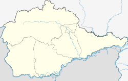
Bira ( Russian Бира ) is an urban-type settlement in Russia . It is located in the Jewish Autonomous Oblast on the river of the same name and has 3167 inhabitants (as of October 14, 2010).
history
The current settlement was built in 1908 on the Amur tributary Bira, from which it was named. The river name itself is taken from the language of an Evenk tribe that once settled in this area and means something like "great water". At the beginning of the 20th century, the founders and the first settlers of Biras mainly pursued logging and hunting. In 1911 a railway station was built near Bira.
After the place was fought over in the Russian Civil War in the early 1920s, it was expanded further in the 1930s, so that a sawmill was built there. As early as 1936, Bira became the center of a Rajon in the Jewish Autonomous Oblast.
In addition to wood processing, there is still a railway workshop in Bira to this day.
Population development
| year | Residents |
|---|---|
| 1939 | 6354 |
| 1959 | 9121 |
| 1970 | 5220 |
| 1979 | 4484 |
| 1989 | 4111 |
| 2002 | 4311 |
| 2010 | 3167 |
Note: census data
Web links
Individual evidence
- ↑ a b Itogi Vserossijskoj perepisi naselenija 2010 goda. Tom 1. Čislennostʹ i razmeščenie naselenija (Results of the All-Russian Census 2010. Volume 1. Number and distribution of the population). Tables 5 , pp. 12-209; 11 , pp. 312–979 (download from the website of the Federal Service for State Statistics of the Russian Federation)

