Priamursky
| Urban-type settlement
Priamurski
Приамурский
|
||||||||||||||||||||||||||||||||||
|
||||||||||||||||||||||||||||||||||
|
||||||||||||||||||||||||||||||||||
Priamurski ( Russian Приаму́рский ) is an urban-type settlement in the Jewish Autonomous Oblast ( Russia ) with 4047 inhabitants (as of October 14, 2010).
geography
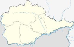
The settlement is in the Amurniederung , just over 7 km from the left bank of the Amur -Hauptarmes and about 3 km from its left tributary Pemsenskaja removed. It is located about 150 km as the crow flies east of the republic capital Birobidzhan , belongs to Smidowitsch Rajon and is about 80 km to the east from its administrative center Smidowitsch . Only 10 km east of Priamurski, across the Amur, are the northern parts of the city of Khabarovsk , the administrative center of the neighboring region of the same name , to which the border of the Jewish Autonomous Oblast in this area is marked by the Amur and its left branch. It is about 15 km to the center of Khabarovsk.
The municipality (gorodskoje posselenije) Priamurski also includes the three surrounding villages imeni Telmana (6 km east of the Amur, ' Thälmann -Dorf' ; until the 1990s also an urban-type settlement), Ossinowka (11 km south-west) and Vladimirovka (8th century) km south).
history
The place was founded in 1888 by resettlers , Cossacks from Transbaikalia , as Pokrovka . From 1935 he was called Molotowo , after the then Prime Minister (Chairman of the Council of People's Commissars ) of the Soviet Union Vyacheslav Molotov . In 1958 the place received the status of an urban-type settlement under its current name, which refers to the location on the Amur.
Population development
| year | Residents |
|---|---|
| 1959 | 3894 |
| 1970 | 3008 |
| 1979 | 3113 |
| 1989 | 3697 |
| 2002 | 3675 |
| 2010 | 4047 |
Note: census data
Economy and Infrastructure
At Priamurski there is a station of the Trans-Siberian Railway ( Priamurskaya , route kilometer 8506 from Moscow ). Sidings lead to Imeni Telmana and Wladimirowka, where there are loading points on the Amur.
To the south, the settlement is bypassed by the new route of the M 58 Amur trunk road from Chita to Khabarovsk, part of the transcontinental road connection. East of the settlement, near the village of Imeni Telmana, the 2.5 km long combined rail and road bridge from Khabarovsk over the Amur and the over 7 km long tunnel that has crossed the river since 1942 begin.
Individual evidence
- ↑ a b Itogi Vserossijskoj perepisi naselenija 2010 goda. Tom 1. Čislennostʹ i razmeščenie naselenija (Results of the All-Russian Census 2010. Volume 1. Number and distribution of the population). Tables 5 , pp. 12-209; 11 , pp. 312–979 (download from the website of the Federal Service for State Statistics of the Russian Federation)
Web links
- Priamursky on the Oblast Administration website (Russian)

