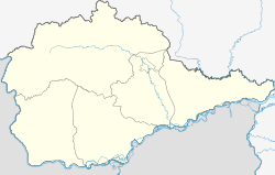
Volochayevka Pervaya
| Village
Volochayevka Pervaya
Волочаевка Первая
|
||||||||||||||||||||||||
|
||||||||||||||||||||||||
|
||||||||||||||||||||||||
Volotschajewka Perwaja ( Russian Волочаевка Первая ; also Volotschajewka-1 , Волочаевка-1 ) is a village (selo) in the Smidowitsch Raion of the Jewish Autonomous Oblast in Russia . It has 1148 inhabitants (as of October 14, 2010).
On the " Hill of Volotschajewka " there is a memorial for the fighting there during the Russian Civil War , when the red troops of the Far Eastern Republic under Vasily Blücher, after several days of fighting in February 1922, entered the white troops who had holed up on the hill Managed to escape and thus enabled the further advance on Khabarovsk . The village is on the Trans-Siberian Railway ( Volotschajewka I station ; 8474 km from Moscow ). About seven kilometers to the east is the urban-type Volotschajewka Wtoraya with the Volotschajewka II train station . There the Wolotschajewka – Dsemgi railway branches off , which connects the Trans-Siberian Railway with the Baikal-Amur mainline near Komsomolsk on the Amur .
Individual evidence
- ↑ a b Itogi Vserossijskoj perepisi naselenija 2010 goda. Tom 1. Čislennostʹ i razmeščenie naselenija (Results of the All-Russian Census 2010. Volume 1. Number and distribution of the population). Tables 5 , pp. 12-209; 11 , pp. 312–979 (download from the website of the Federal Service for State Statistics of the Russian Federation)
Web links
- Photo of the hill ( Memento from December 16, 2015 in the Internet Archive )

