Kyerwa (District)
Kyerwa District
|
|||
|---|---|---|---|
| Basic data | |||
| Country | Tanzania | ||
| region | Kagera | ||
| surface | 3086 km² | ||
| Residents | 321,026 (2012) | ||
| density | 104 inhabitants per km² | ||
| ISO 3166-2 | TZ-05 | ||
Coordinates: 1 ° 18 ′ S , 30 ° 37 ′ E
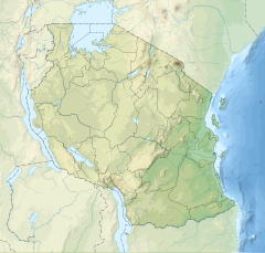
Kyerwa is a district in the Kagera region in northwestern Tanzania . It borders Uganda to the north, the Missenyi district to the east, the Karagwe district to the southeast and south, and Rwanda to the west .
geography
Kyerwa has an area of 3,086 square kilometers and around 320,000 inhabitants (2012 census). The country consists of mountain ranges that are 1500 to 1800 meters high. In between there are swampy valley floors at an altitude of 1100 to 1500 meters above sea level. The largest river is the Kagera , which forms the border with Rwanda, Uganda and also the Missenyi district. The district has a tropical highland climate with two rainy seasons. One rainy season lasts from September to December and the second from March to May. Between 800 and 1000 millimeters of precipitation fall annually, with the amount decreasing from east to west. The average temperature is 26 degrees Celsius.
Administrative division
Kyerwa is divided into four divisions and 18 parishes (wards):
- Isingiro
- Kaisho
- Rutunguru
- Kibingo
- Murongo
- Bugomora
- Kibals
- Mabira
- Businde
- Kamuli
- Nyakatuntu
- Kimuli
- Kikukuru
- Rwabwere
- Nkwenda
- Rukuraijo
- Song amble
- Kyerwa
population
The population rose from 222,841 in the 2002 census to 321,026 in 2012. This corresponds to an annual growth of 3.7 percent and a doubling time of nineteen years. During the same period, the proportion of people over the age of 15 who could read and write rose from 66 to 92 percent.
Facilities and services
- Education: Attending primary schools is free. In return, the district receives state transfers. Of the 27 secondary schools, 21 are public, four are run by private organizations and two by religious organizations. In 2015, 7078 students were taught by 363 teachers in secondary schools.
- Health: The population receives medical care in 32 health facilities.
- Water: In 2019, 48 percent of the population had access to safe and clean water.
Economy and InfrastructureAround 90 percent of the population live from agriculture. There are also small businesses that mainly operate in trade or mining.
|
 |
 |
politics
In Kyerwa, a District Council is elected every five years. Of the 25 elected councilors, twelve belong to the “Party of the Revolution” ( CCM ) and thirteen to the “Party for Democracy and Progress” (CHADEMA) . The chair is Singsbeth Kashunju Runyogote (as of 2019).
Attractions
- Rumanyika Game Reserve: Centrally located in the district, the five hundred square kilometer area offers animal and bird watching, as well as hunts for elephants, elands, waterbuck, roan antelopes, giraffes, warthogs, lions and hippos. Since 2019, the central government has been trying to convert this and four other game reserves in Tanzania into a national park.
- Ibanda Game Reserve: Hunting and wildlife viewing are possible in this two hundred square kilometer reserve located in the northwest of the district.
Web links
Individual evidence
- ↑ a b History | Kyerwa District Council. Retrieved May 6, 2020 .
- ↑ a b 18. Kagera Regional Profile. (PDF) The United Republic of Tanzania, March 2016, p. 16 , accessed on May 6, 2020 .
- ↑ a b c Kyerwa. GoogleMaps, accessed May 6, 2020 (de-US).
- ↑ Kyerwa District Investment Profile 2017. (PDF) Kyerwa District Council, pp. 10–11 , accessed on May 6, 2020 .
- ^ Maps of the World. Russian Army Maps, S. Map 500k - xa36-3 , accessed May 7, 2020 (Russian).
- ↑ 2012 Population and Housing Census. (PDF) National Bureau of Statistics and Ministry of Finance, March 2013, p. 171 , accessed on May 6, 2020 .
- ↑ 18. Kagera Regional Profile. (PDF) The United Republic of Tanzania, March 2016, p. 69 , accessed on May 7, 2020 .
- ↑ Primary Education | Kyerwa District Council. Retrieved May 7, 2020 (Swahili).
- ^ Secondary Education | Kyerwa District Council. Retrieved May 7, 2020 (Swahili).
- ^ Health and social welfare | Kyerwa District Council. Retrieved May 7, 2020 (Swahili).
- ↑ Water | Kyerwa District Council. Retrieved May 6, 2020 (Swahili).
- ↑ Kyerwa District Investment Profile 2017. (PDF) Kyerwa District Council, p. 12 , accessed on May 6, 2020 .
- ↑ Kyerwa District Investment Profile 2017. (PDF) Kyerwa District Council, pp. 13-14 , accessed on May 6, 2020 .
- ↑ 18. Kagera Regional Profile. (PDF) The United Republic of Tanzania, March 2016, pp. 132, 134 , accessed on May 7, 2020 .
- ↑ Kyerwa District Investment Profile 2017. (PDF) Kyerwa District Council, p. 19 , accessed on May 6, 2020 .
- ^ Trunk Road Network. Retrieved May 6, 2020 .
- ↑ Kyerwa District Investment Profile 2017. (PDF) Kyerwa District Council, p. 22 , accessed on May 7, 2020 .
- ^ Siegfried Schröder and Elke Kuhne: Elections in Tanzania 2015. (PDF) Rosa-Luxemburg-Stiftung, November 9, 2015, p. 3 , accessed on May 6, 2020 .
- ↑ Orodha ya Madiwani | Kyerwa District Council. Retrieved May 6, 2020 (Swahili).
- ↑ Mwanzo. Retrieved May 6, 2020 .
- ↑ a b Tanzania in Figures 2018. (PDF) National Bureau of Statistics, June 2019, p. 9 , accessed on May 7, 2020 .
- ↑ Rumanyika Game Reserve. In: Tanzania Zalendo. Retrieved May 7, 2020 (American English).
- ↑ TANZANIA: Five game reserves officially transformed into national parks. February 28, 2019, accessed May 7, 2020 (American English).
- ^ Ibanda Game Reserve. In: Tanzania Zalendo. Retrieved May 7, 2020 (American English).

