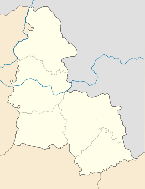
Kyjanytsia
| Kyjanytsia | ||
| Кияниця | ||

|
|
|
| Basic data | ||
|---|---|---|
| Oblast : | Sumy Oblast | |
| Rajon : | Sumy Raion | |
| Height : | 186 m | |
| Area : | Information is missing | |
| Residents : | 698 (2001) | |
| Postcodes : | 42335 | |
| Area code : | +380 542 | |
| Geographic location : | 51 ° 4 ' N , 34 ° 55' E | |
| KOATUU : | 5924785901 | |
| Administrative structure : | 4 villages, 5 settlements | |
| Address: | вул. Супруна буд. 9 42335 селище Кияниця |
|
| Website : | City council website | |
| Statistical information | ||
|
|
||
Kyjanyzja ( Ukrainian Кияниця ; Russian Кияница Kijaniza ) is a settlement ( Selyschtsche ) in the Ukrainian Sumy Oblast with about 700 inhabitants (2001).
The settlement is the administrative center of the eponymous district municipality in northern Sumy Raion to which even the villages Chrapiwschtschina ( Храпівщина ) Jabluniwka ( Яблунівка ) Kortschakiwka ( Корчаківка ) and Nowa Sich ( Нова Січ ) and settlements (Selyschtsche) Iwolschanske ( Іволжанське ), Marjine ( Мар'їне ), Mala Korchakivka ( Мала Корчаківка ) and Warachyn ( Варачине ).
In the village there is a sugar factory built in 1866 by the sugar factory owner Ivan Charitonenko . To the north of the village there is a spacious park on the bank of the dammed Oleschnja , which is a monument of garden art of national importance. In the middle of this park, Ivan Charitonenko had a palace ( Палац Харитоненка ) built in the neo-renaissance style in 1890 . This is now in dire need of renovation.
The village is located on the national highway N 07 and on the left bank of the Oleschnja ( Олешня ), a 40-km-long tributary of the Psel , 27 km north of Rajon- and Oblastzentrum Sumy .
Web links
Individual evidence
- ↑ Local website on the official website of the Verkhovna Rada ; accessed on March 13, 2018 (Ukrainian)
- ↑ Kyjanyzja on travelua ; accessed on March 13, 2018 (Ukrainian)


