Lambs hut
| Lämmerenhütte SAC hut |
||
|---|---|---|
| location | East side of the Wildstrubel massif; Valais , Switzerland ; Valley location: Leukerbad | |
| Mountain range | Bernese Alps | |
| Geographical location: | 610 452 / 138778 | |
| Altitude | 2507 m above sea level M. | |
|
|
||
| owner | SAC Angenstein | |
| Construction type | Hut; stone | |
| Development | 1950 | |
| Usual opening times | Mid-February to mid-May and late June to mid-October and December 26 to January 2 | |
| accommodation | 0 beds, 96 camps | |
| Winter room | 10 bearings | |
| Web link | http://www.laemmerenhuette.ch/ | |
| Hut directory | SAC | |
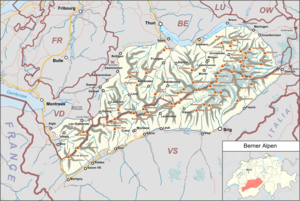
The Lämmerenhütte is a refuge of the Angenstein section of the Swiss Alpine Club , in the canton of Valais in the Bernese Alps ( Switzerland ).
Location and operation
The hut stands on the east side of the Wildstrubel massif at an altitude of 2507 m above sea level. M. , is operated by the Angenstein section of the Swiss Alpine Club and is maintained in spring (ski tours) and summer.
history
The hut, built in 1950, offers a view of the Balmhorn / Altels and the Bietschhorn . It is the starting point for hikes in the direction of Leukerbad, Kandersteg, Adelboden and is also suitable for families. It offers climbing opportunities and high-altitude tours in summer and ski tours in winter.
Approaches
- From the Gemmi pass (normal route) via Lämmerenboden in 2 hours, ascent 250 meters in altitude, level of difficulty T2
- From Leukerbad (normal route) in 4 hours, ascent 1110 meters in altitude, level of difficulty T2 (marked white-red-white)
- From Kandersteg in 6½ hours, ascent 1510 meters in altitude, level of difficulty T2
- Kandersteg-Sunnbüel in 4 hours via Schwarenbach – Daubensee – Gemmipass, level of difficulty T2
- Adelboden-Engstligenalp in 4 hours via Chindbettipass – Rote-Totz-Lücke – Lämmerental (white-blue-white)
- Crans-Montana -Aminona in 7 hours via Cabane des Violettes -Les Outannes-Rothornlücke (white-red-white)
Transitions
Summit tours
- Daubenhorn 2842 m
- Schwarzhorn 3105 m
- Snow horn 3178 m
- Steghorn 3147 m
- Wildstrubel Group 3243 m
Maps
- Swiss Federal Office of Topography swisstopo: topographic maps LK 1: 25,000 Gemmi (summer) and LK 1: 50,000 Wildstrubel (winter)
Web links
Commons : Lämmerenhütte - Collection of images, videos and audio files
Individual evidence
- ↑ Hut information Lämmerenhütte , SAC section Angenstein

