
LORAN-C transmitter Rantum
|
LORAN-C transmitter Rantum
|
||||
|---|---|---|---|---|
 |
||||
| Basic data | ||||
| Place: | Rantum ( Sylt ) | |||
| Country: | Schleswig-Holstein | |||
| Country: | Germany | |||
| Altitude : | 3 m above sea level NHN | |||
| Coordinates: 54 ° 48 ′ 29.9 ″ N , 8 ° 17 ′ 36.9 ″ E | ||||
| Use: | Telecommunication system | |||
| Mast data | ||||
| Construction time : | Early 1960s | |||
| Building material : | steel | |||
| Operating time: | since 1960s | |||
| Last conversion (mast) : | 1996 | |||
| Total height : | 193 m | |||
| Total mass : | 72 t | |||
| Data on the transmission system | ||||
| Waveband : | LW transmitter | |||
| Send type: | Radio navigation | |||
| Shutdown : | December 31, 2015 | |||
| Position map | ||||
|
||||


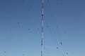
The LORAN-C transmitter Rantum in Rantum on Sylt was the only transmitter of the LORAN-C - radio navigation system in Germany .
History and construction
The LORAN-C transmitter Rantum was put into operation at the beginning of the 1960s at the geographical position 54 ° 48'29.9 "N, 8 ° 17'37.0" E and until the mid-1990s used a capacitively extended, isolated from earth, Guyed steel truss mast of 190 m height. In 1996 this mast was replaced by a similar, but more stable, new construction with a height of 193 m.
Like its predecessor, the new LORAN-C transmission mast Rantum is isolated from earth and capacitively extended by means of shielding cables. It weighs 72 t and is guyed in four levels at 60.52 m, 120.87 m, 154.95 m and 190 m. It had an output power of 250 kW and transmitted on the frequency 100 kHz.
On the night of August 6, 2011, the plant caught fire.
The transmission was stopped on December 31, 2015 at 11 a.m. UTC, until the final shutdown the "flashing mode" was started.

LORAN-C transmitter Rantum on Sylt (2012)
LORAN-C transmitter Rantum on Sylt (2012)


Web links
- LORAN-C transmitter Rantum. In: Structurae
- Loran-C station Sylt. Wasserstraßen- und Schifffahrtsamt Tönning, June 5, 2016, archived from the original ; accessed on December 17, 2019 .
Individual evidence
- ↑ sr: fire in the Loran station and flooded streets | shz.de. Retrieved April 26, 2020 .
- ↑ News for Seafarers Issue 01/2016 - Part 4 Messages. (WSA Tönning 153/15) 01/16. Federal Maritime and Hydrographic Agency , January 5, 2016, accessed on December 17, 2019 .