Lac Lesdiguières
| Lac Lesdiguières | ||
|---|---|---|
| Geographical location | Nunavik , North du Québec in Québec (Canada) | |
| Drain | to Lac Headwind , to Lac Ikirtuuq |
|
| Data | ||
| Coordinates | 60 ° 38 '41 " N , 74 ° 49' 56" W | |
|
|
||
| Altitude above sea level | 235 m | |
| surface | 75 km² | |
The Lac Lesdiguières is a lake in the north of the Canadian province of Quebec .
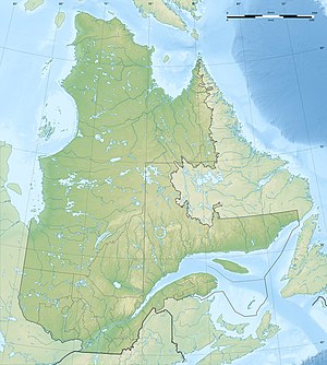
Lac Lesdiguières is centrally located on the Ungava Peninsula . The lake is 140 km northeast of the Hudson Bay settlement of Puvirnituq . The Lac Lesdiguières is located in the area of the Canadian Shield at an altitude of about 235 m . The watershed between Hudson Bay in the west and Ungava Bay in the east runs through the lake. Lac Lesdiguières is drained via the lakes Lac Headwind , Lac Calme and Lac Klotz, which adjoin to the east . Its water flows over the rivers Rivière Lepellé and Rivière Arnaud to Ungava Bay. Another outflow leads west to Lake Ikirtuuq and on to the Rivière Decoumte River . The Lac Lesdiguières has an area of 75 km². The lake is characterized by a large island in the center of the lake.
The lake got its current name in 1946. This refers to Louis de Bonne de Missègle (1717-1760), who fell at the battle of Sainte-Foy and, according to his son, was a descendant of François de Bonne, duc de Lesdiguières .
