Lac Témiscouata
| Lac Témiscouata | ||
|---|---|---|

|
||
| Île Notre-Dame | ||
| Geographical location | Bas-Saint-Laurent in Quebec (Canada) | |
| Drain | Rivière Madawaska | |
| Islands | Île Notre-Dame | |
| Places on the shore | Cabano | |
| Data | ||
| Coordinates | 47 ° 41 ′ N , 68 ° 51 ′ W | |
|
|
||
| surface | 66 km² | |
| length | 39 km | |
| width | 5 km | |
| volume | 2,193.5 km³ | |
| Maximum depth | 121 m | |
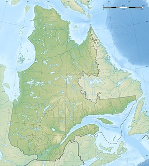
The Lac Témiscouata is a lake in northeastern North America and is located in the Canadian province of Quebec .
It has a length of around 39 km and a maximum width of 5 km. The Rivière Madawaska forms at its southern end and flows into the Saint John River after 48 km .
To the south of the St. Lawrence River, an elongated valley, shaped by the Ice Age, extends in a north-south direction, in the middle of which Lac Témiscouata has formed. It is surrounded by wooded hills, most of which slope steeply into the lake. The name Témiscouata comes from the Algonquin language and accordingly means "very deep lake" or "deep water". A project Parc National du Lac-Témiscouata ( Provincial Park Lac Témiscouata) east of the lake is currently in preparation and covers a total of 213 km². The largest town on the lake is Cabano , the site of the 19th century British Fort Ingall .
history
Lac Témiscouata belonged to the traditional residential area of the Maliseet , a Algonkinstamm the Abenaki - Confederation . A well-used trade route, the Témiscouata- Portage , a canoe and land route from Fundy Bay to the St. Lawrence River , ran along the lake .
The border between Canada and the USA runs nearby , which was for a long time disputed between what was then British North America and the United States and which almost led to the Aroostook War in 1838/39 . The conflict finally ended without bloodshed with the Webster-Ashburton Treaty in 1842 . As the conflict progressed, the British built a number of forts in the area in 1839, Grand Sault and Petit Sault ( Edmundston ) in New Brunswick and Fort Degele and Fort Ingall in Québec, to counter a possible American invasion. The most important post was Fort Ingall at the southern end of Lac Témiscouata, which should block the Témiscouata portage. The fort consisted of eight buildings, was abandoned in 1842, reconstructed after excavations between 1972 and 1978, and now serves as a museum.
The Petit Témis Interprovincial Bicycle Path , a well-known 134 km long bicycle route, runs from Rivière-du-Loup to Edmundston and follows a disused Canadian National Railway along the lake.
Web links
Individual evidence
- ↑ Commission de toponymie du Québec - Lac Témiscouata
- ↑ Fort Ingall ( Memento of the original from June 11, 2008 in the Internet Archive ) Info: The archive link was automatically inserted and not yet checked. Please check the original and archive link according to the instructions and then remove this notice.
