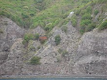
Ladder Bay
| Ladder Bay | ||
|---|---|---|
| Waters | Caribbean Sea ( Atlantic Ocean ) | |
| Land mass | Saba , Caribbean Netherlands | |
| Geographical location | 17 ° 38 '2 " N , 63 ° 15' 22" W | |
|
|
||
The Ladder Bay (in German "Ladder Bay") is a bay on the west coast of the Dutch island of Saba in the eastern Caribbean . Since Saba has no natural harbors or larger beaches, Ladder Bay has long been the only way to enter the island. This fact only changed with the opening of the island port of Fort Bay (1972) on the south coast and the small airport Juancho E. Yrausquin Airport (1963) on the northeast coast. The unloading of people and goods made it necessary to land them in small boats on the tiny beach of the bay and then to carry them up over about 900 steps, almost vertically carved into the rock. There is also a small house on the cliffs that used to be used for customs matters. This building can still be visited today.
The bay's waters are now protected and are part of the Saba National Marine Park , which also provides some berths in the bay to prevent damage to the structures on the seabed. Underwater there is a labyrinth-like system of trenches, small caves and rocky outcrops formed by flowing lava .
Individual evidence
- ↑ The Ladder. In: beautiful-saba.nl. Retrieved August 8, 2019 (Dutch).
- ↑ French yacht Salvaged from the rocks in Ladder Bay - Updated. In: saba-news.com. March 18, 2017, accessed August 8, 2019 .
- ↑ Saba National Marine Park - SITE DESCRIPTION - General and Physical Features. Accessed August 8, 2019 .

