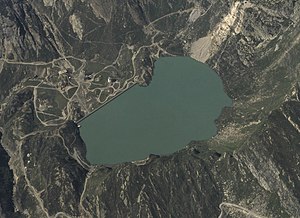
Lake Robièi
| Lake Robièi | |||||||
|---|---|---|---|---|---|---|---|
| 1973 aerial photo | |||||||
|
|||||||
|
|
|||||||
| Coordinates | 682 857 / 144371 | ||||||
| Data on the structure | |||||||
| Lock type: | Gravity dam | ||||||
| Construction time: | 1965-1967 | ||||||
| Height above foundation level : | 68 m | ||||||
| Height of the structure crown: | 1941 m above sea level M. | ||||||
| Building volume: | 180,000 m³ | ||||||
| Crown length: | 360 m | ||||||
| Crown width: | 4.5 m | ||||||
| Base width: | 50 m | ||||||
| Operator: | Officine idroelettriche della Maggia SA | ||||||
| Data on the reservoir | |||||||
| Altitude (at congestion destination ) | 1940 m above sea level M. | ||||||
| Water surface | 23.8 ha | ||||||
| Reservoir length | 500 m | ||||||
| Storage space | 6.5 million m³ | ||||||
| Total storage space : | 6.7 million m³ | ||||||
| Catchment area | 1.52 km² | ||||||
| Design flood : | 30 m³ / s | ||||||
The Lago di Robièi is an equalization basin of the Maggia power plants in the north of the canton of Ticino . It has a usable volume of 6.5 million with a total volume of 6.7 million cubic meters and is located at 1940 m above sea level. M. . The nearby Lago del Zött is connected to the Lago di Robièi by a tunnel, so that the two lakes are connected to one another according to the principle of communicating vessels .
The reservoir absorbs the underwater from the Altstafel headquarters on the Valais side, which is fed into the lake through a 13 km long gravity tunnel before it is fed to the Bavona headquarters. The Robièi headquarters can also dispense processed water from Lago dei Cavagnöö , Lago Sfundau and Lago del Narèt into the lake or pump water from Lago di Robièi into the aforementioned lakes. The lake also stores the water from the Basòdino glacier , which enters the lake via Lago del Zött.
The Lago di Robièi lies at the far end of the Bavona valley , which belongs to the municipality of Cevio . From the village of Bignasco in the Maggia valley , one reaches San Carlo , the farthest hamlet in the valley, via a well-developed side street , where the valley station of the San Carlo – Robièi cable car is located about a hundred meters above the settlement , which leads to the reservoir 900 m higher. The heavy-duty cable car was built in 1972 for power plant construction and is also used for tourism during the summer months. The dam can be visited.
literature
- David Grassi: Diga di Robièi . In: Swiss Dam Committee (ed.): Swissdams.ch . ( swissdams.ch [PDF]).
Web links
- FOEN : Information systems and methods: Water network - evaluations of lakes in Switzerland ( Memento of October 5, 2008 in the Internet Archive )
- Lago di Robiei on hikr.org
- Lago di Robiei on schweizersee.ch
Individual evidence
- ^ A b David Grassi: Diga di Robièi.
- ↑ OFIMA system diagram. Retrieved June 10, 2020 .
- ↑ Information about the cable car. In: robiei.ch. Retrieved June 13, 2020 .
- ↑ Nature trail in the dam. robiei.ch, accessed on June 13, 2020 .


